Login
Register


CYTS
Timmins (Victor M. Power) Airport
VFR Chart of CYTS
Sectional Charts at SkyVector.com
IFR Chart of CYTS
Enroute Charts at SkyVector.com
Location Information for CYTS
Coordinates: N48°34.15' / W81°22.65'View all Airports in Ontario, Canada.
Elevation is 968 feet MSL.
Magnetic Variation is 11° West
Time Zone is UTC-5(4).
Operations Data
|
|
Airport Communications
| Radio | 122.3 PTC avbl (E) (Emergency only 705-264-6009) |
|---|---|
| Remote Communications Outlet (RCO) | London Radio 123.55 (FISE) 126.7 (bcst) |
| Automated Terminal Information Service (ATIS) | 124.95 |
| Mandatory Frequency (MF) | Radio 122.3 5NM 4000 ASL (CAR 602.98) |
| Peripheral Station (PAL) | Toronto Center 128.3 |
Nearby Navigation Aids
|
| ||||||||||||||||||||||||||||||


Runway 03/21
| Dimensions: | 6001 x 150 feet. | |
|---|---|---|
| Surface: | ||
| Remarks | ASPH | |
| Runway 03 | Runway 21 | |
| Runway Heading: | 031° | 211° |
| Approach Lights | SSALR: High Intensity Approach Lighting System with Runway Alignment Indicator Lights | Omni-Directional Approach Lighting System |
| Glide Slope Indicator | PAPI for aircraft with eye-to-wheel height up to 25 feet. | PAPI for aircraft with eye-to-wheel height up to 25 feet. |
Runway 10/28
| Dimensions: | 4905 x 150 feet. | |
|---|---|---|
| Surface: | ||
| Remarks | ASPH | |
| Runway 10 | Runway 28 | |
| Runway Heading: | 101° | 281° |
| Approach Lights | Omni-Directional Approach Lighting System | Omni-Directional Approach Lighting System |
| Glide Slope Indicator | PAPI for aircraft with eye-to-wheel height up to 25 feet. | PAPI for aircraft with eye-to-wheel height up to 25 feet. |
Runway Conditions Reporting Source
Operator RSC/CRFI & Win maint avbl 10-03Z O/T 4 hrs PN, call out chg. PCN
Services Available
| Fuel Available | 100LL, JA-1 (FSII avbl), HPR 10-01Z Mon-Fri, 1130-2400Z Sat-Sun O/T 1 hr PN 705-360-8888 |
|---|---|
| Oil Available | All |
| Servicing Available | Storage, Minor Repairs, Major Repairs |
| Supporting Fluids, Systems, and Oxygen | D-Ice Type I & IV Air Creebec 705-264-9521. D-Ice Type I & A-Ice Type III Maintair Aviation Services Ltd. 705-262-4849 |
| Jet Aircraft Starting Units (JASU) | 10/15 |
| Military Contract Fuel | Air Creebec Inc. 705-264-9521 |
Public Facilities
| Location | Facilities | Remarks |
|---|---|---|
| On Aerodrome | Telephone, Food, Taxi, Car Rental | |
| Within 5 NM | Medical Aid, Accomodations |
Flight Planning
| Instructions | Pilots to open/close VFR flt plan with London rdo FISE or by phone. |
|---|---|
| Flight Information Centre (FIC) | London 866-WXBRIEF (Toll free within Canada) or 866-541-4104 (Toll free within Canada & USA) |
| Weather (WX) | METAR H24. TAF H24, issue times: 02, 08, 14, 20Z. |
Aerodrome Operator
City of Timmins 705-360-2636
10-03Z Nov 1-Apr 30
1100-2130Z Mon-Fri exc hols,
13-16Z Sat-Sun & hols May 1-Oct 31
Cert Ldg fees
Nearby Airports with Instrument Procedures
| ID | Name | Heading / Distance | ||
|---|---|---|---|---|
 |
CYCN | Cochrane Airport | 034° | 35.3 |
|
CYYU | Kapuskasing Airport | 330° | 66.5 |
|
CYXR | Earlton (Timiskaming Regional) ON Airport | 140° | 80.8 |
|
CYLD | Chapleau Airport | 252° | 90.9 |
|
CTA4 | St-Bruno-de-Guigues Airport | 140° | 103.7 |
|
CYUY | Rouyn-Noranda Airport | 112° | 104.0 |
|
CYSB | Sudbury Airport | 179° | 119.0 |
Airport Images
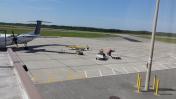
By: serimutswairo
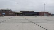
By: serimutswairo


