Login
Register
EDVK
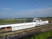
Kassel-Calden Airport
VFR Chart of EDVK
Sectional Charts at SkyVector.com
IFR Chart of EDVK
Enroute Charts at SkyVector.com
Location Information for EDVK
Coordinates: N51°25.25' / E9°23.53'View all Airports in Hessen, Germany.
Elevation is 860.0 feet MSL.
Operations Data
|
|
Airport Communications
| BREMEN RADAR Approach: | 126.65 |
|---|---|
| KASSEL ATIS ATIS: | 129.20 |
| KASSEL GROUND Ground Control: | 121.90 |
| KASSEL TOWER Tower: | 118.10 |
Nearby Navigation Aids
|
| ||||||||||||||||||||||||||||||||||||||||||||||||||||||||||||
Runway 09/27
| Dimensions: | 8202 x 148 feet / 2500 x 45 meters | |
|---|---|---|
| Surface: | Hard | |
| Runway 09 | Runway 27 | |
| Coordinates: | N51°25.31' / E9°22.46' | N51°25.19' / E9°24.60' |
| Elevation: | 860 | 802 |
| Runway Heading: | 093° | 273° |
Nearby Airports with Instrument Procedures
| ID | Name | Heading / Distance | ||
|---|---|---|---|---|
 |
ETHF | Fritzlar Airport | 192° | 18.8 |
 |
EDLP | Paderborn Lippstadt Airport | 292° | 31.3 |
 |
ETHB | Buckeburg Airport | 347° | 52.8 |
 |
ETNW | Wunstorf AB Airport | 001° | 62.3 |
 |
EDDV | Hannover Airport | 009° | 63.4 |
 |
EDDE | Erfurt-Weimar Airport | 113° | 64.8 |
 |
EDGS | Siegerland Airport | 229° | 65.5 |
 |
EDLW | Dortmund Airport | 275° | 67.0 |
 |
EDVE | Braunschweig-Wolfsburg Airport | 038° | 69.3 |
 |
ETHC | Celle Airport | 018° | 74.1 |
 |
EDDG | Muenster-Osnabrueck Airport | 304° | 76.7 |
 |
EDBC | Cochstedt Airport | 070° | 80.1 |


Comments
Informations
The informations are old.
Now is there a new Airport with the Runway 09/27 2500m asphalt. With Apron and international Traffic
Pages