Login
Register


ESSV
Visby Airport
VFR Chart of ESSV
Sectional Charts at SkyVector.com
IFR Chart of ESSV
Enroute Charts at SkyVector.com
Location Information for ESSV
Coordinates: N57°39.77' / E18°20.77'View all Airports in Gotland, Sweden.
Elevation is 164.0 feet MSL.
Operations Data
|
|
Airport Communications
| VISBY APPROACH Approach: | 126.15 |
|---|---|
| VISBY Tower: | 120.30 |
Nearby Navigation Aids
|
| ||||||||||||||||||||||||||||||||||||||||||||||||||||||


Runway 03/21
| Dimensions: | 6562 x 148 feet / 2000 x 45 meters | |
|---|---|---|
| Surface: | Hard | |
| Runway 03 | Runway 21 | |
| Coordinates: | N57°39.26' / E18°20.41' | N57°40.27' / E18°21.13' |
| Elevation: | 140 | 137 |
| Runway Heading: | 015° | 195° |
Runway 10/28
| Dimensions: | 3609 x 131 feet / 1100 x 40 meters | |
|---|---|---|
| Surface: | Unknown | |
| Runway 10 | Runway 28 | |
| Coordinates: | N57°39.06' / E18°19.78' | N57°38.94' / E18°20.86' |
| Elevation: | 142 | 164 |
| Runway Heading: | 095° | 275° |
Nearby Airports with Instrument Procedures
| ID | Name | Heading / Distance | ||
|---|---|---|---|---|
 |
ESKN | Stockholm Skavsta Airport | 326° | 81.7 |
|
ESSP | Norrkoping/Kungsangen Airport | 310° | 86.9 |
|
ESMQ | Kalmar Airport | 229° | 89.3 |
|
ESSL | Linkoping-Saab Airport | 298° | 96.1 |
|
ESCF | Linkoping/Malmen Airport | 297° | 100.3 |
|
ESSB | Stockholm Bromma Airport | 353° | 102.5 |
|
EVLA | Liepaja Airport | 126° | 113.3 |
|
ESSU | Eskilstuna Airport | 333° | 113.9 |
|
ESSA | Stockholm Arlanda Airport | 353° | 120.4 |
|
ESOW | Vasteras Airport | 335° | 127.7 |
|
EYPA | Palanga/International Airport | 137° | 136.1 |
Airport Images
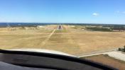
By: czyeager

By: Lars Friberg


Comments
Radio frequences
Visby Tower 120.305
Visby Control 126.155