Login
Register
FANC
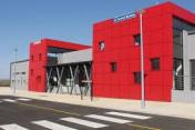
Newcastle Airport
VFR Chart of FANC
Sectional Charts at SkyVector.com
IFR Chart of FANC
Enroute Charts at SkyVector.com
Location Information for FANC
Coordinates: S27°46.37' / E29°58.58'View all Airports in KwaZulu-Natal, South Africa.
Elevation is 4074.0 feet MSL.
Operations Data
|
|
Nearby Navigation Aids
|
| ||||||||||||||||||||||||||||||||||||||||||||||||||||||||||||
Runway 11/29
| Dimensions: | 4593 x 75 feet / 1400 x 23 meters | |
|---|---|---|
| Surface: | Hard | |
| Runway 11 | Runway 29 | |
| Coordinates: | S27°46.23' / E29°58.16' | S27°46.24' / E29°59.01' |
| Elevation: | 4075 | 4055 |
| Runway Heading: | 112° | 292° |
Nearby Airports with Instrument Procedures
| ID | Name | Heading / Distance | ||
|---|---|---|---|---|
 |
FAGY | Greytown Airport | 158° | 86.9 |
 |
FABM | Bethlehem Airport | 251° | 91.6 |
 |
FDMS | Matsapha Airport | 044° | 103.0 |
 |
FAPM | Pietermaritzburg Airport | 168° | 114.3 |
 |
FALE | King Shaka International Airport | 151° | 125.5 |
 |
FDSK | Sikhuphe International Airport | 048° | 125.9 |
 |
FARB | Richards Bay Airport | 117° | 126.2 |
 |
FAGM | Rand/Johannesburg Airport | 312° | 134.0 |
 |
FAOR | O R Tambo International Airport | 316° | 135.1 |
 |
FAWK | Waterkloof AFB Airport | 320° | 149.6 |
 |
FALA | Lanseria Airport | 314° | 155.4 |
 |
FXMM | Maseru Moshoeshoe Airport | 231° | 162.2 |


