Login
Register


FARG
Rustenburg Airport
VFR Chart of FARG
Sectional Charts at SkyVector.com
IFR Chart of FARG
Enroute Charts at SkyVector.com
Location Information for FARG
Coordinates: S25°38.67' / E27°16.27'View all Airports in North West, South Africa.
Elevation is 3700.0 feet MSL.
Operations Data
|
|
Nearby Navigation Aids
|
| ||||||||||||||||||||||||||||||||||||

Runway
| Surface: | Hard | |
|---|---|---|
Nearby Airports with Instrument Procedures
| ID | Name | Heading / Distance | ||
|---|---|---|---|---|
 |
FAPN | Pilanesberg International Airport | 343° | 19.3 |
|
FALA | Lanseria Airport | 116° | 39.6 |
|
FAWB | Wonderboom/Pretoria Airport | 090° | 51.5 |
|
FAWK | Waterkloof AFB Airport | 102° | 52.8 |
|
FAGM | Rand/Johannesburg Airport | 127° | 59.5 |
|
FAOR | O R Tambo International Airport | 119° | 60.2 |
|
FAMM | George Dick Montshioa Airport | 263° | 94.1 |
|
FBSK | Sir Seretse Khama Airport | 311° | 98.3 |
|
FAPP | Polokwane Airport | 048° | 160.5 |
Airport Images
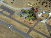
By: Skywalker


Comments
Concrete Tower
I constantly hear on the airband radio pilots referencing the "Concrete Tower". I can't find it. Can any local pilots please assist? I'm guesing it might be here: https://goo.gl/maps/AzeD7xLuhtDXztYW9
Concrete Tower
Started training in that area not too long ago, here is the location for it: https://maps.app.goo.gl/v5xbFwyFdh8pPfSM6