Login
Register


FWKI
Lilongwe Kamuzu International Airport
VFR Chart of FWKI
Sectional Charts at SkyVector.com
IFR Chart of FWKI
Enroute Charts at SkyVector.com
Location Information for FWKI
Coordinates: S13°47.00' / E33°46.65'View all Airports in Lilongwe, Malawi.
Elevation is 4029.0 feet MSL.
Operations Data
|
|
Airport Communications
| LILONGWE INTL Approach: | 128.00 |
|---|---|
| LILONGWE Radar: | 124.70 |
| LILONGWE INTL Tower: | 118.70 |
Nearby Navigation Aids
|
| ||||||||||||||||||||||||||||||||||||||||||||||||||||||||||||


Runway 14/32
| Dimensions: | 11614 x 148 feet / 3540 x 45 meters | |
|---|---|---|
| Surface: | Hard | |
| Runway 14 | Runway 32 | |
| Coordinates: | S13°46.75' / E33°46.10' | S13°47.98' / E33°47.62' |
| Elevation: | 4025 | 4019 |
| Runway Heading: | 133° | 313° |
Nearby Airports with Instrument Procedures
| ID | Name | Heading / Distance | ||
|---|---|---|---|---|
 |
FQUG | Ulongwe Airport | 148° | 64.3 |
|
FLCP | Chipata Airport | 280° | 70.8 |
|
FQLC | Lichinga Airport | 070° | 92.1 |
|
FLLD | Lundazi Airport | 338° | 95.9 |
|
FLMF | Mfuwe Airport | 286° | 111.9 |
|
FWCL | Blantyre Chileka Airport | 148° | 132.8 |
|
FLPE | Petauke Airport | 259° | 151.4 |
|
FLMP | Mpika Airport | 309° | 177.9 |
Airport Images
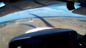
By: SR22Alex


