Login
Register


XLL
Allentown Queen City Municipal Airport
Official FAA Data Effective 2025-11-27 0901Z
Chart Supplement

VFR Chart of KXLL
Sectional Charts at SkyVector.com
IFR Chart of KXLL
Enroute Charts at SkyVector.com
Location Information for KXLL
Coordinates: N40°34.22' / W75°29.30'Located 02 miles SW of Allentown, Pennsylvania on 201 acres of land. View all Airports in Pennsylvania.
Surveyed Elevation is 399 feet MSL.
Operations Data
|
|
Airport Communications
| AWOS-3: | 127.875 Tel. 610-231-3111 |
|---|---|
| ALLENTOWN APPROACH: | 119.65 ;3000 FT & BLW 124.45 ;ABV 3000 FT 351.8 |
| ALLENTOWN DEPARTURE: | 119.65 ;3000 FT & BLW 124.45 ;ABV 3000 FT 351.8 |
| IC: | 119.65 ;3000 FT & BLW 124.45 ;ABV 3000 FT |
| CLEARANCE DELIVERY: | 118.9 |
| UNICOM: | 122.700 |
| CTAF: | 122.700 |
| ATIS at ABE (5.4 NE): | 126.975 |
| ASOS at ABE (5.8 NE): | 126.975 610-477-0813 |
| AWOS-3 at UKT (9.5 SE): | 119.475 215-538-7610 |
Nearby Navigation Aids
|
| ||||||||||||||||||||||||||||||||||||||||||||||||||||||||||||


Runway 07/25
| Dimensions: | 3950 x 75 feet / 1204 x 23 meters | |
|---|---|---|
| Surface: | Asphalt / Grooved in Good Condition | |
| Weight Limits: | S-12 | |
| Edge Lighting: | Medium Intensity | |
| Runway 07 | Runway 25 | |
| Coordinates: | N40°33.99' / W75°29.66' | N40°34.34' / W75°28.93' |
| Elevation: | 386.4 | 387.8 |
| Traffic Pattern: | Left | Left |
| Runway Heading: | 58° True | 238° True |
| Markings: | Non-Precision Instrument in good condition. | Basic in good condition. |
| Glide Slope Indicator | P4L (3.00° Glide Path Angle) | P4L (3.50° Glide Path Angle) UNUSBL BYD 3 DEG L OF CRS. |
| REIL: | Yes | Yes |
| Obstacles: | 16 ft Brush 354 ft from runway, 95 ft right of center 4FT SHRUB, 154 FT FM RWY END, 177 FT R. |
23 ft Pole 635 ft from runway, 112 ft left of center |
Runway 15/33
| Dimensions: | 3160 x 75 feet / 963 x 23 meters | |
|---|---|---|
| Surface: | Asphalt in Excellent Condition | |
| Weight Limits: | S-12 | |
| Edge Lighting: | Medium Intensity | |
| Runway 15 | Runway 33 | |
| Coordinates: | N40°34.47' / W75°29.54' | N40°34.10' / W75°29.06' |
| Elevation: | 386.1 | 399.0 |
| Traffic Pattern: | Left | Left |
| Runway Heading: | 135° True | 315° True |
| Markings: | Basic in good condition. | Basic in good condition. |
Services Available
| Fuel: | 100LL (blue), Jet-A |
|---|---|
| Transient Storage: | Hangars,Tiedowns |
| Airframe Repair: | MAJOR |
| Engine Repair: | MAJOR |
| Bottled Oxygen: | NOT AVAILABLE |
| Bulk Oxygen: | NONE |
| Other Services: | AIR FREIGHT SERVICES,PILOT INSTRUCTION,AIRCRAFT RENTAL |
Ownership Information
| Ownership: | Publicly owned | |
|---|---|---|
| Owner: | LEHIGH NORTHAM ARPT AUTH | |
| 3311 AIRPORT RD | ||
| ALLENTOWN, PA 18109 | ||
| 610-266-6001 | ||
| Manager: | THOMAS R STOUDT | |
| 1730 VULTEE ST | ||
| ALLENTOWN, PA 18109 | ||
| 610-791-5193 | ||
Other Remarks
- DEER, GROUNDHOGS & BIRDS ON & INVOF ARPT.
- NOISE ABATEMENT PROC IN EFCT, FOR DETAILS CTC AMGR.
- FOR SVC AFT HRS CTC 610-266-6000.
- FOR CD CTC ALLENTOWN APCH AT 800-728-6322.
- ACTVT REIL RWY 07/25; MIRL RWY 07/25 & 15/33 - CTAF.
Weather Minimums

Instrument Approach Procedure (IAP) Charts
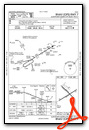
Nearby Airports with Instrument Procedures
| ID | Name | Heading / Distance | ||
|---|---|---|---|---|
 |
KABE | Lehigh Valley International Airport | 023° | 5.4 |
|
KUKT | Quakertown Airport | 148° | 9.5 |
|
KCKZ | Pennridge Airport | 140° | 14.1 |
|
N43 | Braden Airpark Airport | 047° | 15.2 |
|
22N | Jake Arner Memorial Airport | 319° | 19.0 |
|
KPTW | Heritage Field Airport | 189° | 20.1 |
|
N47 | Pottstown Municipal Airport | 204° | 20.4 |
|
N85 | Alexandria Airport | 087° | 21.5 |
|
KDYL | Doylestown Airport | 130° | 22.0 |
|
N40 | Sky Manor Airport | 090° | 23.3 |
|
KRDG | Reading Regional/Carl A Spaatz Field Airport | 242° | 24.7 |
|
KLOM | Wings Field Airport | 158° | 27.9 |


Comments
Lehigh Valley International Airport guide
Please check out the Lehigh Valley International Airport guide here: http://abe-airport.com/
JM
Admin
Pages