Login
Register


LFOB
Beauvais Tille Airport
VFR Chart of LFOB
Sectional Charts at SkyVector.com
IFR Chart of LFOB
Enroute Charts at SkyVector.com
Location Information for LFOB
Coordinates: N49°27.27' / E2°6.77'View all Airports in Picardie, France.
Elevation is 359.0 feet MSL.
Operations Data
|
|
Airport Communications
| BEAUVAIS APPROACH Approach: | 121.40 |
|---|---|
| BEAUVAIS APPROACH Approach: | 123.98 |
| BEAUVAIS ATIS: | 118.38 |
| BEAUVAIS TOWER Tower: | 121.40 |
| BEAUVAIS TOWER Tower: | 123.98 |
Nearby Navigation Aids
|
| ||||||||||||||||||||||||||||||||||||||||||||||||||||||||||||


Runway 12/30
| Dimensions: | 7969 x 148 feet / 2429 x 45 meters | |
|---|---|---|
| Surface: | Hard | |
| Runway 12 | Runway 30 | |
| Coordinates: | N49°27.49' / E2°6.26' | N49°26.77' / E2°7.90' |
| Elevation: | 352 | 297 |
| Runway Heading: | 123° | 303° |
| Displaced Threshold: | 144 Feet | |
Runway 04/22
| Dimensions: | 2323 x 59 feet / 708 x 18 meters | |
|---|---|---|
| Surface: | Unknown | |
| Runway 04 | Runway 22 | |
| Coordinates: | N49°27.44' / E2°7.01' | N49°27.73' / E2°7.40' |
| Elevation: | 346 | 359 |
| Runway Heading: | 041° | 221° |
Nearby Airports with Instrument Procedures
| ID | Name | Heading / Distance | ||
|---|---|---|---|---|
 |
LFPT | Pontoise Cormeilles En Vexin Airport | 187° | 21.7 |
|
LFPG | Paris Charles De Gaulle Airport | 147° | 31.7 |
|
LFPB | Paris Le Bourget Airport | 155° | 31.9 |
|
LFOP | Rouen Vallee De Seine Airport | 264° | 36.6 |
|
LFAQ | Albert Bray Airport | 035° | 38.3 |
|
LFPV | Villacoublay Velizy A.B Airport | 175° | 41.0 |
|
LFPN | Toussus-Le-Noble Airport | 180° | 42.3 |
|
LFPL | Lognes Emerainville Airport | 151° | 43.0 |
|
LFOE | Evreux Fauville Airport | 234° | 43.4 |
|
LFPO | Paris Orly Airport | 166° | 45.1 |
|
LFAB | Dieppe St.Aubin Airport | 303° | 47.6 |
|
LFPM | Melun Villaroche Airport | 156° | 55.5 |
Airport Images
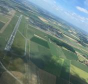
By: maximeguillaud


