Login
Register
MHLM
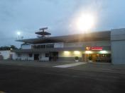
Ramon Villeda Morales International Airport
VFR Chart of MHLM
Sectional Charts at SkyVector.com
IFR Chart of MHLM
Enroute Charts at SkyVector.com
Location Information for MHLM
Coordinates: N15°27.12' / W87°55.45'View all Airports in Cortés, Honduras.
Elevation is 92.0 feet MSL.
Operations Data
|
|
Airport Communications
| LA MESA CONTROL Approach: | 119.70 |
|---|---|
| LA MESA CONTROL Approach: | 127.10 |
| ATIS LA MESA ATIS: | 132.20 |
| CONTROL TERRESTRE Ground Control: | 121.90 |
| TORRE LA MESA Tower: | 118.20 |
Nearby Navigation Aids
|
| ||||||||||||||||||||||||||||||||||||||||||||||||||||||||||||
Runway 04/22
| Dimensions: | 9206 x 148 feet / 2806 x 45 meters | |
|---|---|---|
| Surface: | Hard | |
| Runway 04 | Runway 22 | |
| Coordinates: | N15°26.62' / W87°55.88' | N15°27.70' / W87°54.94' |
| Elevation: | 90 | 84 |
| Runway Heading: | 041° | 221° |
| Displaced Threshold: | 669 Feet | |
Nearby Airports with Instrument Procedures
| ID | Name | Heading / Distance | ||
|---|---|---|---|---|
 |
MGPB | Puerto Barrios Airport | 293° | 41.7 |
 |
MHLC | Goloson Internacional Airport | 074° | 64.4 |
 |
MHPR | Palmerola Internacional Airport | 164° | 66.3 |
 |
MHTG | Toncontin International Airport | 153° | 92.7 |
 |
MHRO | Juan Manuel Galvez International Airport | 057° | 96.1 |
 |
MSSS | Ilopango International Airport | 213° | 125.7 |
 |
MGMM | Mundo Maya International Airport | 308° | 142.1 |
 |
MGGT | La Aurora International / La Aurora Airport | 251° | 159.8 |


Comments
MHLM GROUND SUPPORT OPS
Flight Coordinator, Certified and Expirienced Flight Dispatcher, VIP services Provider, Overflight and Landing Permits Req
Luis Suarez
Pages