Login
Register
MMHO
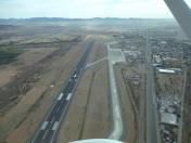
Gral. Ignacio Pesqueira Garcia Airport
VFR Chart of MMHO
Sectional Charts at SkyVector.com
IFR Chart of MMHO
Enroute Charts at SkyVector.com
Location Information for MMHO
Coordinates: N29°5.75' / W111°2.87'View all Airports in Sonora, Mexico.
Elevation is 627.0 feet MSL.
Operations Data
|
|
Airport Communications
| APROXIMACION HERMOSILLO Approach: | 121.40 |
|---|---|
| EMERGENCIA HERMOSILLO Emergency: | 121.50 |
| INFORMACION DE VUELO HERM Information: | 122.30 |
| TORRE HERMOSILLO Tower: | 118.70 |
Nearby Navigation Aids
|
| ||||||||||||||||||||||||||||||||||||
Runway 05/23
| Dimensions: | 7546 x 148 feet / 2300 x 45 meters | |
|---|---|---|
| Surface: | Hard | |
| Runway 05 | Runway 23 | |
| Coordinates: | N29°5.28' / W111°3.76' | N29°5.92' / W111°2.54' |
| Elevation: | 604 | 627 |
| Runway Heading: | 050° | 230° |
Nearby Airports with Instrument Procedures
| ID | Name | Heading / Distance | ||
|---|---|---|---|---|
 |
MMGM | Gral. Jose Maria Yanez Airport | 174° | 67.7 |
 |
MMCN | Cd. Obregon Internacional Airport | 147° | 120.5 |


