Login
Register


OMDB
Dubai International Airport
VFR Chart of OMDB
Sectional Charts at SkyVector.com
IFR Chart of OMDB
Enroute Charts at SkyVector.com
Location Information for OMDB
Coordinates: N25°15.17' / E55°21.87'View all Airports in Dubay, United Arab Emirates.
Elevation is 62.0 feet MSL.
Operations Data
|
|
Airport Communications
| MINHAD APPROACH Approach: | 122.50 |
|---|---|
| MINHAD APPROACH Approach: | 126.02 |
| DUBAI ARRIVALS Arrival: | 120.25 |
| DUBAI ARRIVALS Arrival: | 124.90 |
| DUBAI AIRPORT ATIS: | 126.27 |
| DUBAI AIRPORT ATIS: | 131.70 |
| DUBAI DELIVERY Clearance Delivery: | 120.35 |
| DUBAI DEPARTURES SOUTH Departure: | 121.02 |
| DUBAI DEP NORTH/SOUTH Departure: | 124.45 |
| DUBAI DEPARTURES NORTH Departure: | 126.20 |
| DUBAI DIRECTOR Director: | 120.25 |
| DUBAI DIRECTOR Director: | 127.90 |
| DUBAI GROUND 1 Ground Control: | 118.35 |
| DUBAI GROUND Ground Control: | 118.85 |
| DUBAI GROUND 2 Ground Control: | 121.65 |
| DUBAI Information: | 126.77 |
| AL MAKTOUM RADAR Radar: | 124.02 |
| AL MAKTOUM RADAR Radar: | 126.02 |
| DUBAI TOWER NORTH Tower: | 118.75 |
| DUBAI TOWER Tower: | 119.05 |
| DUBAI TOWER SOUTH Tower: | 119.55 |
Nearby Navigation Aids
|
| ||||||||||||||||||||||||||||||||||||||||||||||||||||||||||||


Runway 12R/30L
| Dimensions: | 14590 x 197 feet / 4447 x 60 meters | |
|---|---|---|
| Surface: | Hard | |
| Runway 12R | Runway 30L | |
| Coordinates: | N25°15.17' / E55°21.86' | N25°14.16' / E55°23.69' |
| Elevation: | 11 | 60 |
| Runway Heading: | 119° | 299° |
| Displaced Threshold: | 2346 Feet | 433 Feet |
Runway 12L/30R
| Dimensions: | 14275 x 197 feet / 4351 x 60 meters | |
|---|---|---|
| Surface: | Unknown | |
| Runway 12L | Runway 30R | |
| Coordinates: | N25°15.88' / E55°21.03' | N25°14.86' / E55°22.86' |
| Elevation: | 11 | 32 |
| Runway Heading: | 119° | 299° |
| Displaced Threshold: | 1476 Feet | 984 Feet |
Nearby Airports with Instrument Procedures
| ID | Name | Heading / Distance | ||
|---|---|---|---|---|
 |
OMSJ | Sharjah International Airport | 060° | 9.4 |
|
OMDM | Dubai Minhad Airport | 179° | 13.5 |
|
OMDW | Al Maktoum International Airport | 207° | 22.5 |
|
OMRK | Ras Al Khaimah International Airport | 055° | 37.9 |
|
OIBA | Abumusa Island Airport | 334° | 41.4 |
|
OMFJ | Fujairah International Airport | 098° | 52.9 |
|
OIBS | Sirri Island Airport | 311° | 59.4 |
|
OMAL | Al Ain International Airport | 167° | 60.8 |
|
OMAA | Abu Dhabi International Airport | 218° | 62.6 |
|
OMAD | Al Bateen Executive Airport | 225° | 69.8 |
|
OOKB | Khasab Airport | 040° | 72.6 |
|
OMAM | Abu Dhabi-Al Dhafra AB Airport | 216° | 75.2 |
Airport Images
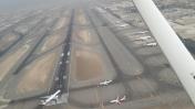
By: Said - pedro


