Login
Register


UPP
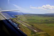
Upolu Airport
Official FAA Data Effective 2025-12-25 0901Z
Chart Supplement

VFR Chart of PHUP
Sectional Charts at SkyVector.com
IFR Chart of PHUP
Enroute Charts at SkyVector.com
Location Information for PHUP
Coordinates: N20°15.91' / W155°51.60'Located 03 miles NW of Hawi, Hawaii on 82 acres of land. View all Airports in Hawaii.
Estimated Elevation is 96 feet MSL.
Operations Data
|
|
Airport Communications
| CTAF: | 122.900 |
|---|---|
| AWOS-3PT at MUE (19.2 SE): | 120.0 808-887-8127 |
| AWOS-3PT at HNM (33.0 N): | 118.325 808-248-4864 |
| ATIS at KOA (33.3 S): | 127.4 |
Nearby Navigation Aids
|
| ||||||||||||||||||||||||||||||||||||||||||


Runway 07/25
| Dimensions: | 3800 x 75 feet / 1158 x 23 meters | |
|---|---|---|
| Surface: | Asphalt in Fair Condition | |
| Weight Limits: | S-30 | |
| Edge Lighting: | Medium Intensity | |
| Runway 07 | Runway 25 | |
| Coordinates: | N20°15.84' / W155°51.92' | N20°15.98' / W155°51.27' |
| Elevation: | 92.0 | 79.5 |
| Traffic Pattern: | Left | Right |
| Markings: | Non-Precision Instrument in fair condition. | Non-Precision Instrument in fair condition. |
| Obstacles: | 25 ft Hill 500 ft from runway, 120 ft left of center | |
Services Available
| Fuel: | NONE |
|---|---|
| Transient Storage: | Tiedowns |
| Airframe Repair: | NONE |
| Engine Repair: | NONE |
| Bottled Oxygen: | NONE |
| Bulk Oxygen: | NONE |
| Other Services: | PARACHUTE JUMP ACTIVITY |
Ownership Information
| Ownership: | Publicly owned | |
|---|---|---|
| Owner: | STATE OF HAWAII AIRPORTS DIVISION | |
| 400 RODGERS BLVD SUITE 700 | ||
| HONOLULU, HI 96819 | ||
| 808-838-8701 | ||
| Manager: | CHAUNCEY WONG YUEN | ERNEST ALFONSO MAINT PHONE WAIMEA-KOHALA 808-887-8126. |
| 73-200 KUPIPI STREET | ||
| KAILUA-KONA, HI 96740-2645 | ||
| 808-327-9520 | ||
Other Remarks
- <TPA SMALL ACFT 800' MSL. LARGE ACFT 1500' MSL.
- PPR FOR TRANSIENT PARKING.
- PPR FM ARPT MGR PHONE (808)327-9520 FOR TRANSPORTATION OF DIVISION 1.1,1.2,1.3 EXPLOSIVES IN OR OUT OF AIRPORT.
- ALL HELICOPTERS CONFINE OPNS TO PAVED AREAS ONLY.
- OCCASIONAL FLOCKS OF BIRDS ON AND INVOF ARPT.
- SKYDIVING ACT ON AND IN VCNTY OF ARPT.
- FOR CD CTC HONOLULU CONTROL FACILITY AT 808-840-6262.
- ACTVT MIRL RWY 07/25 - CTAF.
Nearby Airports with Instrument Procedures
| ID | Name | Heading / Distance | ||
|---|---|---|---|---|
 |
PHMU | Waimea-Kohala Airport | 145° | 19.1 |
|
PHHN | Hana Airport | 344° | 32.9 |
|
PHKO | Ellison Onizuka Kona International At Keahole Airport | 198° | 33.2 |
|
PHOG | Kahului Airport | 319° | 49.7 |
|
PHTO | Hilo International Airport | 125° | 56.2 |
|
PHNY | Lanai Airport | 297° | 68.9 |
|
PHLU | Kalaupapa Airport | 312° | 84.4 |
|
PHMK | Molokai Airport | 307° | 87.5 |
|
PHNL | Daniel K Inouye International Airport | 298° | 131.8 |
|
PHJR | Kalaeloa (John Rodgers Field) Airport | 297° | 139.0 |