Login
Register
RKJB
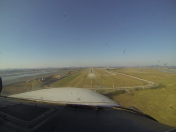
Muan International Airport
VFR Chart of RKJB
Sectional Charts at SkyVector.com
IFR Chart of RKJB
Enroute Charts at SkyVector.com
Location Information for RKJB
Coordinates: N34°59.48' / E126°22.97'View all Airports in Jeollanam-do, South Korea.
Elevation is 52.0 feet MSL.
Operations Data
|
|
Airport Communications
| GWANGJU APPROACH Approach: | 120.47 |
|---|---|
| GWANGJU APPROACH Approach: | 130.00 |
| GWANGJU APPROACH Approach: | 228.90 |
| GWANGJU APPROACH Approach: | 265.50 |
| GWANGJU APPROACH Approach: | 319.20 |
| MUAN INFORMATION ATIS: | 127.42 |
| GWANGJU DEPARTURE Departure: | 124.00 |
| GWANGJU DEPARTURE Departure: | 124.70 |
| GWANGJU DEPARTURE Departure: | 347.20 |
| MUAN Emergency: | 121.50 |
| MUAN Emergency: | 243.00 |
| MUAN GROUND Ground Control: | 121.70 |
| MUAN GROUND Ground Control: | 317.45 |
| MUAN TOWER Tower: | 118.25 |
| MUAN TOWER Tower: | 118.85 |
Nearby Navigation Aids
|
| ||||||||||||||||||||||||||||||||||||||||||||||||
Runway 01/19
| Dimensions: | 9186 x 148 feet / 2800 x 45 meters | |
|---|---|---|
| Surface: | Hard | |
| Runway 01 | Runway 19 | |
| Coordinates: | N34°58.73' / E126°22.97' | N35°0.24' / E126°22.96' |
| Elevation: | 33 | 51 |
| Runway Heading: | 007° | 187° |
Nearby Airports with Instrument Procedures
| ID | Name | Heading / Distance | ||
|---|---|---|---|---|
 |
RKJJ | Gwangju Airport | 068° | 22.5 |
 |
RKJK | Gunsan Airport | 011° | 55.8 |
 |
RKJY | Yeosu Airport | 097° | 61.6 |
 |
RKPS | Sacheon Airport | 085° | 83.4 |
 |
RKPC | Jeju International Airport | 176° | 88.8 |
 |
RKPD | Jeju/Jeongseok Airport | 170° | 96.8 |
 |
RKTU | Cheongju / International Airport | 027° | 116.8 |
 |
RKTN | Daegu International Airport | 063° | 124.0 |
 |
RKPK | Busan/Gimhae International Airport | 084° | 126.3 |
 |
RKTY | Yecheon Airport | 043° | 137.5 |
 |
RKPU | Ulsan Airport | 075° | 150.2 |
 |
RJDT | Tsushima Airport | 105° | 151.9 |


