Login
Register


RPUR
Baler Community Airport Airport
VFR Chart of RPUR
Sectional Charts at SkyVector.com
IFR Chart of RPUR
Enroute Charts at SkyVector.com
Location Information for RPUR
Coordinates: N15°43.77' / E121°30.22'View all Airports in Aurora, Philippines.
Elevation is 30.0 feet MSL.
Operations Data
|
|
Nearby Navigation Aids
|
| ||||||||||||||||||||||||||||||||||||||||||||||||


Runway 05/23
| Dimensions: | 3776 x 98 feet / 1151 x 30 meters | |
|---|---|---|
| Surface: | Hard | |
| Runway 05 | Runway 23 | |
| Coordinates: | N15°43.59' / E121°29.76' | N15°43.99' / E121°30.25' |
| Elevation: | 82 | 98 |
| Runway Heading: | 050° | 230° |
Nearby Airports with Instrument Procedures
| ID | Name | Heading / Distance | ||
|---|---|---|---|---|
 |
RPLC | Diosdado Macapagal International Airport | 239° | 63.6 |
|
RPLL | Ninoy Aquino International Airport | 201° | 78.2 |
|
RPLB | Subic Bay Airport | 232° | 90.7 |
|
RPUT | Tuguegarao Airport | 006° | 115.1 |
Airport Images
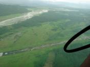
By: rusty55


