Login
Register


SBCY
Marechal Rondon International Airport
VFR Chart of SBCY
Sectional Charts at SkyVector.com
IFR Chart of SBCY
Enroute Charts at SkyVector.com
Location Information for SBCY
Coordinates: S15°39.00' / W56°7.05'View all Airports in Mato Grosso, Brazil.
Elevation is 617.0 feet MSL.
Operations Data
|
|
Airport Communications
| CUIABA CONTROL Approach: | 119.40 |
|---|---|
| CUIABA CONTROL Approach: | 120.35 |
| CUIABA CONTROL Approach: | 128.90 |
| MARECHAL RODON INTL ATIS: | 127.85 |
| MARECHAL RODON INTL Emergency: | 121.50 |
| CUIABA GROUND Ground Control: | 121.90 |
| CUIABA TOWER Tower: | 118.10 |
Nearby Navigation Aids
|
| ||||||||||||||||||||||||

Runway 17/35
| Dimensions: | 7546 x 148 feet / 2300 x 45 meters | |
|---|---|---|
| Surface: | Hard | |
| Runway 17 | Runway 35 | |
| Coordinates: | S15°38.62' / W56°7.29' | S15°39.73' / W56°6.71' |
| Elevation: | 617 | 591 |
| Runway Heading: | 171° | 351° |
Nearby Airports with Instrument Procedures
| ID | Name | Heading / Distance | ||
|---|---|---|---|---|
 |
SBRD | Maestro Marinho Franco Airport | 124° | 98.2 |
Airport Images
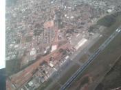
By: max lucidos
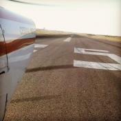
By: max lucidos


