Login
Register


SBIL
Jorge Amado Airport
VFR Chart of SBIL
Sectional Charts at SkyVector.com
IFR Chart of SBIL
Enroute Charts at SkyVector.com
Location Information for SBIL
Coordinates: S14°48.90' / W39°2.00'View all Airports in Bahia, Brazil.
Elevation is 14.0 feet MSL.
Operations Data
|
|
Airport Communications
| ILHENUS Approach: | 120.10 |
|---|---|
| ILHENUS Information: | 120.10 |
Nearby Navigation Aids
|
| ||||||||||||||||||||||||||||||||||||||||||


Runway 11/29
| Dimensions: | 5174 x 148 feet / 1577 x 45 meters | |
|---|---|---|
| Surface: | Hard | |
| Runway 11 | Runway 29 | |
| Coordinates: | S14°48.97' / W39°2.43' | S14°48.95' / W39°1.62' |
| Elevation: | 8 | 14 |
| Runway Heading: | 112° | 292° |
| Displaced Threshold: | 361 Feet | |
Nearby Airports with Instrument Procedures
| ID | Name | Heading / Distance | ||
|---|---|---|---|---|
 |
SBTC | Una/Comandatuba Airport | 176° | 32.2 |
|
SBPS | Porto Seguro Airport | 181° | 97.0 |
|
SBTV | Terravista Airport | 182° | 103.2 |
|
SBQV | Vitoria Da Conquista Airport | 268° | 106.4 |
|
SBVC | Glauber De Andrade Rocha Airport | 266° | 109.5 |
|
SBSV | Deputado Luis Eduardo Magalhae Airport | 020° | 121.2 |
Airport Images
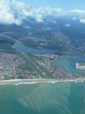
By: Alfredo Ghidini Neto

By: Ramon Schaeffer


