Login
Register


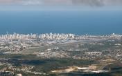
SBRF
Guararapes - Gilberto F International Airport
VFR Chart of SBRF
Sectional Charts at SkyVector.com
IFR Chart of SBRF
Enroute Charts at SkyVector.com
Location Information for SBRF
Coordinates: S8°7.58' / W34°55.37'View all Airports in Pernambuco, Brazil.
Elevation is 33.0 feet MSL.
Operations Data
|
|
Airport Communications
| RECIFE CONTROL Approach: | 119.50 |
|---|---|
| RECIFE CONTROL Approach: | 119.95 |
| RECIFE CONTROL Approach: | 120.40 |
| RECIFE CONTROL Approach: | 129.20 |
| RECIFE CONTROL Approach: | 129.60 |
| RECIFE INTL ATIS: | 127.65 |
| RECIFE TRAFFIC Clearance Delivery: | 118.90 |
| RECIFE CONTROL Emergency: | 121.50 |
| RECIFE GROUND Ground Control: | 121.85 |
| RECIFE OPS Operations: | 118.90 |
| RECIFE OPS Operations: | 122.50 |
| RECIFE TOWER Tower: | 118.35 |
| RECIFE TOWER Tower: | 122.80 |
| RECIFE TORRE Tower: | 125.25 |
Nearby Navigation Aids
|
| ||||||||||||||||||||||||||||||||||||||||||||||||


Runway 18/36
| Dimensions: | 9865 x 148 feet / 3007 x 45 meters | |
|---|---|---|
| Surface: | Hard | |
| Runway 18 | Runway 36 | |
| Coordinates: | S8°6.83' / W34°55.64' | S8°8.38' / W34°55.13' |
| Elevation: | 23 | 32 |
| Runway Heading: | 184° | 004° |
Nearby Airports with Instrument Procedures
| ID | Name | Heading / Distance | ||
|---|---|---|---|---|
 |
SBJP | Presidente Castro Pinto International Airport | 358° | 58.4 |
|
SJCH | Brejo/Fernando J Pereira Santo Airport | 268° | 74.9 |
|
SBKG | Presidente Joao Suassuna Airport | 311° | 77.3 |
|
SBMO | Zumbi Dos Palmares Airport | 211° | 97.5 |
Airport Images

By: jeffersonfelipe...
By: Ramon Schaeffer


Comments
RECIFE TOWER 118.350 - FREQUENCY