Login
Register


SSCN
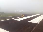
Canela Airport
VFR Chart of SSCN
Sectional Charts at SkyVector.com
IFR Chart of SSCN
Enroute Charts at SkyVector.com
Location Information for SSCN
Coordinates: S29°22.23' / W50°49.93'View all Airports in Rio Grande do Sul, Brazil.
Elevation is 2746.0 feet MSL.
Operations Data
|
|
Nearby Navigation Aids
|
| ||||||||||||||||||||||||||||||||||||||||||||||||||||||


Runway
| Surface: | Hard | |
|---|---|---|
Nearby Airports with Instrument Procedures
| ID | Name | Heading / Distance | ||
|---|---|---|---|---|
 |
SBCX | Hugo Cantergiani Airport | 299° | 21.5 |
|
SBCO | Campo Nossa Senhora De Fatima Airport | 205° | 38.1 |
|
SBPA | Salgado Filho Airport | 205° | 41.3 |
|
SSIM | Forquilhinha - Criciuma Airport | 062° | 83.7 |
|
SBLJ | Lages Airport | 017° | 99.4 |
|
SBJA | Regional Sul Airport | 066° | 102.1 |
|
SBPF | Lauro Kurtz Airport | 310° | 103.7 |
|
SNCP | Aeroporto Regional Do Planalto Airport | 013° | 106.9 |
|
SBSM | Santa Maria Airport | 261° | 151.1 |
|
SBFL | Hercilio Luz Airport | 050° | 157.7 |
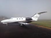


Comments
F.B.O. SERVICES
F.B.O. SERVICES
TRI PHONE +55 54 9999 1636
Email contato@voetri.com
website voetri.com
Pages