Login
Register
VYHH
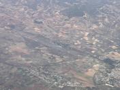
Heho Airport
VFR Chart of VYHH
Sectional Charts at SkyVector.com
IFR Chart of VYHH
Enroute Charts at SkyVector.com
Location Information for VYHH
Coordinates: N20°44.82' / E96°47.52'View all Airports in Shan, Myanmar.
Elevation is 3935.0 feet MSL.
Operations Data
|
|
Airport Communications
| HEHO APPROACH Approach: | 119.70 |
|---|---|
| HEHO TOWER Tower: | 118.10 |
Nearby Navigation Aids
|
| ||||||||||||||||||||||||||||||||||||||||||||||||||||||||||||
Runway 18/36
| Dimensions: | 8501 x 151 feet / 2591 x 46 meters | |
|---|---|---|
| Surface: | Hard | |
| Runway 18 | Runway 36 | |
| Coordinates: | N20°45.52' / E96°47.52' | N20°44.12' / E96°47.52' |
| Elevation: | 3935 | 3844 |
| Runway Heading: | 181° | 001° |
Nearby Airports with Instrument Procedures
| ID | Name | Heading / Distance | ||
|---|---|---|---|---|
 |
VYLK | Loikaw Airport | 159° | 67.4 |
 |
VYMD | Mandalay Airport | 321° | 73.1 |
 |
VYNT | Naypyitaw Airport | 206° | 75.0 |
 |
VYBG | Nyaung U Airport | 284° | 107.7 |
 |
VYMW | Magway Airport | 251° | 108.7 |
 |
VTCH | Mae Hong Son Airport | 142° | 109.2 |
 |
VYMS | Mong Hsat Airport | 095° | 139.5 |
 |
VYKG | Kengtung Airport | 077° | 163.0 |
 |
VYAN | Ann Airport | 249° | 166.6 |
 |
VTCC | Chiang Mai International Airport | 133° | 170.4 |


