Login
Register


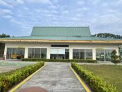
WIBL
Sultan Syarif Haroen Setia Neg Airport
VFR Chart of WIBL
Sectional Charts at SkyVector.com
IFR Chart of WIBL
Enroute Charts at SkyVector.com
Location Information for WIBL
Coordinates: N0°30.28' / E101°55.37'View all Airports in Riau, Indonesia.
Elevation is 95.0 feet MSL.
Operations Data
|
|
Airport Communications
| SULTAN HAROEN AD INFO Information: | 122.25 |
|---|
Nearby Navigation Aids
|
| ||||||||||||||||||||||||||||||||||||||||||||||||||||||||||||


Runway 18/36
| Dimensions: | 5446 x 98 feet / 1660 x 30 meters | |
|---|---|---|
| Surface: | Hard | |
| Runway 18 | Runway 36 | |
| Coordinates: | N0°30.38' / E101°55.40' | N0°29.48' / E101°55.41' |
| Elevation: | 95 | 82 |
| Runway Heading: | 180° | 000° |
Nearby Airports with Instrument Procedures
| ID | Name | Heading / Distance | ||
|---|---|---|---|---|
 |
WIBB | Sultan Syarif Kasim II Airport | 264° | 28.8 |
|
WMKM | Malacca Airport | 010° | 106.8 |
|
WSAT | Tengah Airport | 063° | 119.6 |
|
WMKJ | Johor Bahru/Senai International Airport | 057° | 125.0 |
|
WIEE | Minangkabau Airport | 231° | 125.0 |
|
WIMG | Padang Tabing Airport | 228° | 125.4 |
|
WSSL | Seletar Airport | 065° | 129.0 |
|
WSAP | Paya Lebar Airport | 066° | 129.4 |
|
WSSS | Singapore Changi International Airport | 067° | 134.3 |
|
WIDD | Batam / Hang Nadim Airport | 074° | 136.7 |
|
WIDN | Raja Haji Fisabilillah Airport | 081° | 158.5 |
|
WIMN | Raja Sisingamangaraja Xii Airport | 300° | 204.8 |


Comments
Freq changed
Please adjust freq changed from 122.25 to be 118.55 (NOTAM NO. C0294/25 NOTAMN)
Pages