Login
Register


YBHM
Hamilton Island Airport
VFR Chart of YBHM
Sectional Charts at SkyVector.com
IFR Chart of YBHM
Enroute Charts at SkyVector.com
Location Information for YBHM
Coordinates: S20°21.48' / E148°57.10'View all Airports in Queensland, Australia.
Elevation is 15.0 feet MSL.
Operations Data
|
|
Airport Communications
| HAMILTON ATIS ATIS: | 128.35 |
|---|---|
| HAMILTON ISLAND AWIB: | 124.75 |
| HAMILTON TOWER Tower: | 118.70 |
Nearby Navigation Aids
|
| ||||||||||||||||||||||||||||||||||||||||||||||||


Runway 14/32
| Dimensions: | 5794 x 148 feet / 1766 x 45 meters | |
|---|---|---|
| Surface: | Hard | |
| Runway 14 | Runway 32 | |
| Coordinates: | S20°21.08' / E148°56.80' | S20°21.82' / E148°57.39' |
| Elevation: | 15 | 15 |
| Runway Heading: | 135° | 315° |
Nearby Airports with Instrument Procedures
| ID | Name | Heading / Distance | ||
|---|---|---|---|---|
 |
YBPN | Proserpine/Whitsunday Coast Airport | 249° | 24.0 |
|
YBMK | Mackay Airport | 165° | 50.3 |
|
YMRB | Moranbah Airport | 205° | 112.8 |
|
YBTL | Townsville/Townsville International Airport | 297° | 140.2 |
|
YPAM | Palm Island Airport | 305° | 165.0 |
Airport Images
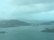
By: westwindtwo
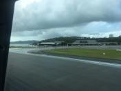
By: westwindtwo


