Login
Register


YMML
Melbourne Int Airport
VFR Chart of YMML
Sectional Charts at SkyVector.com
IFR Chart of YMML
Enroute Charts at SkyVector.com
Location Information for YMML
Coordinates: S37°40.40' / E144°50.60'View all Airports in Victoria, Australia.
Elevation is 434.0 feet MSL.
Operations Data
|
|
Airport Communications
| MELBOURNE Approach: | 132.00 |
|---|---|
| MELBOURNE ATIS: | 114.10 |
| MELBOURNE ATIS: | 118.00 |
| MELBOURNE Departure: | 118.90 |
| MELBOURNE Departure: | 129.40 |
| MELBOURNE Ground Control: | 121.70 |
| MELBOURNE Tower: | 120.50 |
Nearby Navigation Aids
|
| ||||||||||||||||||||||||||||||||||||||||||||||||||||||||||||


Runway 16/34
| Dimensions: | 11998 x 197 feet / 3657 x 60 meters | |
|---|---|---|
| Surface: | Hard | |
| Runway 16 | Runway 34 | |
| Coordinates: | S37°39.19' / E144°50.09' | S37°41.15' / E144°50.46' |
| Elevation: | 432 | 330 |
| Runway Heading: | 160° | 340° |
Runway 09/27
| Dimensions: | 7500 x 148 feet / 2286 x 45 meters | |
|---|---|---|
| Surface: | Unknown | |
| Runway 09 | Runway 27 | |
| Coordinates: | S37°39.65' / E144°49.34' | S37°39.74' / E144°50.89' |
| Elevation: | 395 | 407 |
| Runway Heading: | 083° | 263° |
Nearby Airports with Instrument Procedures
| ID | Name | Heading / Distance | ||
|---|---|---|---|---|
 |
YMEN | Melbourne/Essendon Airport | 139° | 4.3 |
|
YMPC | Point Cook Airport | 195° | 16.1 |
|
YBSL | Rowsley/Brooks Landing Airport | 264° | 23.9 |
|
YMAV | Avalon Airport | 218° | 28.2 |
|
YTDN | Tooradin Airport | 139° | 42.6 |
|
YMNG | Mangalore Airport | 019° | 49.8 |
|
YBLT | Ballarat Airport | 280° | 51.1 |
|
YBDG | Bendigo Airport | 336° | 61.2 |
|
YSHT | Shepparton Airport | 019° | 79.1 |
|
YLTV | Latrobe Valley Airport | 113° | 83.6 |
|
YWGT | Wangaratta Airport | 043° | 103.1 |
|
YWSL | West Sale Airport | 104° | 103.9 |
Airport Images
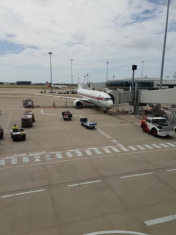
By: Chaddy1


