United States Alaska VFR Sectional Charts VFR Terminal Area Charts Helicopter Route Charts IFR Enroute High Charts IFR Enroute Low Charts IFR Area Charts
Seattle Sectional Chart Great Falls Sectional Chart Billings Sectional Chart Twin Cities Sectional Chart Green Bay Sectional Chart Lake Huron Sectional Chart Montreal Sectional Chart Halifax Sectional Chart Klamath Falls Sectional Chart Salt Lake City Sectional Chart Cheyenne Sectional Chart Omaha Sectional Chart Chicago Sectional Chart Detroit Sectional Chart New York Sectional Chart San Francisco Sectional Chart Las Vegas Sectional Chart Denver Sectional Chart Wichita Sectional Chart Kansas City Sectional Chart St. Louis Sectional Chart Cincinnati Sectional Chart Washington Sectional Chart Los Angeles Sectional Chart Phoenix Sectional Chart Albuquerque Sectional Chart Dallas - Ft Worth Sectional Chart Memphis Sectional Chart Atlanta Sectional Chart Charlotte Sectional Chart El Paso Sectional Chart San Antonio Sectional Chart Houston Sectional Chart New Orleans Sectional Chart Jacksonville Sectional Chart Brownsville Sectional Chart Miami Sectional Chart Atlanta Terminal Area Chart Baltimore - Washington Terminal Area Chart Boston Terminal Area Chart Charlotte Terminal Area Chart Chicago Terminal Area Chart Cincinnati Terminal Area Chart Cleveland Terminal Area Chart Dallas - Ft Worth Terminal Area Chart Denver Terminal Area Chart Detroit Terminal Area Chart Houston Terminal Area Chart Kansas City Terminal Area Chart Las Vegas Terminal Area Chart Los Angeles Terminal Area Chart Memphis Terminal Area Chart Miami Terminal Area Chart Minneapolis - St Paul Terminal Area Chart New Orleans Terminal Area Chart New York Terminal Area Chart Philadelphia Terminal Area Chart Phoenix Terminal Area Chart Pittsburgh Terminal Area Chart St. Louis Terminal Area Chart Salt Lake City Terminal Area Chart San Diego Terminal Area Chart San Francisco Terminal Area Chart Seattle Terminal Area Chart Tampa Terminal Area Chart Orlando Terminal Area Chart Colorado Springs Terminal Area Chart Grand Canyon VFR Chart Enroute L-1 Enroute L-2 Enroute L-3 Enroute L-4 Enroute L-5 Enroute L-6 Enroute L-7 Enroute L-8 Enroute L-9 Enroute L-10 Enroute L-11 Enroute L-12 Enroute L-13 Enroute L-14 Enroute L-15 Enroute L-16 Enroute L-17 Enroute L-18 Enroute L-19 Enroute L-20 Enroute L-21 Enroute L-22 Enroute L-23 Enroute L-24 Enroute L-25 Enroute L-26 Enroute L-27 Enroute L-28 Enroute L-29 Enroute L-30 Enroute L-31 Enroute L-32 Enroute L-33 Enroute L-34 Enroute L-35 Enroute L-36 Enroute H-12 Enroute H-1 Enroute H-2 Enroute H-3 Enroute H-4 Enroute H-5 Enroute H-6 Enroute H-7 Enroute H-8 Enroute H-9 Enroute H-10 Enroute H-11 Atlanta Area Chart Chicago Area Chart Denver Area Chart Detroit Area Chart Dallas - Ft. Worth Area Chart Jacksonville Area Chart Kansas City Area Chart Los Angeles Area Chart Miami Area Chart Minneapolis - St. Paul Area Chart Phoenix Area Chart San Francisco Area Chart St. Louis Area Chart D.C. Area Chart New York Helicopter Chart Inset Boston Helicopter Chart Inset D.C. Helicopter Chart Inset Dallas Helicopter Chart Inset Salt Lake City Helicopter Chart Inset Ogden Helicopter Chart Inset New York Helicopter Chart Long Island Helicopter Chart Boston Helicopter Chart D.C. Helicopter Chart Baltimore Helicopter Chart Detroit Helicopter Chart Chicago Helicopter Chart Dallas Helicopter Chart Houston Helicopter Chart Los Angeles Helicopter Chart West Los Angeles Helicopter Chart East Salt Lake City Helicopter Chart Ogden Helicopter Chart Anchorage Sectional Chart Bethel Sectional Chart Cape Lisburne Sectional Chart Cold Bay Sectional Chart Dawson Sectional Chart Dutch Harbor Sectional Chart Fairbanks Sectional Chart Juneau Sectional Chart Ketchikan Sectional Chart Kodiak Sectional Chart McGrath Sectional Chart Nome Sectional Chart Point Barrow Sectional Chart Seward Sectional Chart Western Aleutian Islands Sectional Chart West Western Aleutian Islands Sectional Chart East Whitehorse Sectional Chart Fairbanks Terminal Area Chart Anchorage Terminal Area Chart Alaska Enroute L-3 Alaska Enroute L-4 Alaska Enroute L-1 Alaska Enroute L-2 East Alaska Enroute L-2 Central Alaska Enroute L-2 West Alaska Enroute H-1 Alaska Enroute H-2 Nome Area Chart Fairbanks Area Chart Anchorage Area Chart Juneau Area Chart

We Love Pilots!


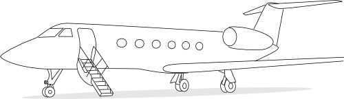
Kern Valley Airport (L05) is great little airport located just south of the mountain-sports town of Kernville, providing service for small private planes, an on-site cafe, on-site camping for pilots flying in, and minor maintenance. The airport has radio communications during the daylight hours -usually manned by the cafe host offering weather advisories and taking your burger orders!

Airport Services:

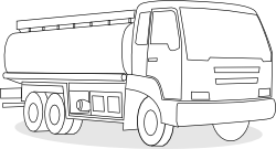
  • Fuel: We now have 100LL AvGas!  Only $5.05/gal!! ​Stop by the cafe to get someone to pump from the truck or text/call ahead to 310-710-9781
  • Cafe: Open for breakfast and lunch 7:00AM to 3:00PM Thurs.-Mon.  Click here for more info or call 760-376-2852
  • Maintenance: Text Rick (661-345-7755) for maintenance help for now.  Soon a new full maintenance shop will be coming.  ​
  • Camping: Great camping is available right on the airport. A separate tiedown area (bring your own tiedowns) for camping in a tree shaded area, within walking distance of the river. Tables, firepits, toilets and an outdoor shower can be found in the camping area. This is a very beautiful and quiet place (except for those darn airplanes taking off and landing). From the campground, one can walk 5 minutes down the taxiway to our Airpark Cafe. See more camping info in our Campground section here.
  • Transportation:  A short term crew car is available for a small fee.  This is a country airport, do not expect a Cadillac.  Text Rick at 661-345-7755 for more info.

At this time, no conventional rental car agency cars are available anywhere in the valley.
A truck is available for rent via the Turo app. Text Justin at 916-585-3857 for more info.

Operating Hours: DAY ONLY, dawn to dusk. Kern Valley Airport is surrounded by the Southern Sierras with peaks from 6500FT to over 10,000FT.  You should plan to be on the ground by sunset.​

​Elevation: 2614ft MSL

Runway: 3500' x 50', asphalt

Communications: CTAF/UNICOM – 122.8

Traffic Pattern:
Runway 17 = Right pattern (see picture of landing pattern in pictures gallery)
Runway 35 = Left pattern
NOTE: Both traffic patterns are on the west side of the runway as there are mountains on the east side of the runway.

​Winds:
Typical canyon winds generally prevail. Light, early-morning down-canyon winds from the north favor Runway 35, though early morning departures on Runway 17 with a light tailwind are common to avoid rising terrain and the town of Kernville to the north.
Later, the wind often reverses mid-morning and flows from the south, up the Kern River canyon, favoring Runway 17.

Windsocks:
There are three windsocks:

  • ​One mid-field in the segmented circle on the west side of the runway
  • One on the west side, between the segmented circle and the south end of the runway
  • One on the east side of the north end of the runway.

We hope to see you soon!


Information for FBO Operator

Are you affiliated with Kern Valley Airport at L05 ?

Contact us Today to take ownership of this page.

You will then be able log in and edit this page.

For assistance visit our Information for FBOs page.