Login
Register
DABS
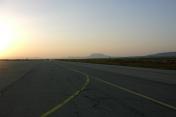
Tebessa/Cheikh Larbi Tebessi Airport
VFR Chart of DABS
Sectional Charts at SkyVector.com
IFR Chart of DABS
Enroute Charts at SkyVector.com
Location Information for DABS
Coordinates: N35°25.96' / E8°7.54'View all Airports in Tébessa, Algeria.
Elevation is 2657.0 feet MSL.
Operations Data
|
|
Airport Communications
| TEBESSA Tower: | 118.10 |
|---|---|
| TEBESSA Tower: | 119.70 |
Nearby Navigation Aids
|
| ||||||||||||||||||||||||||||||||||||||||||||||||||||||||||||
Runway 11/29
| Dimensions: | 9843 x 148 feet / 3000 x 45 meters | |
|---|---|---|
| Surface: | Hard | |
| Runway 11 | Runway 29 | |
| Coordinates: | N35°26.31' / E8°6.51' | N35°25.67' / E8°8.34' |
| Elevation: | 2638 | 2657 |
| Runway Heading: | 111° | 291° |
Runway 12/30
| Dimensions: | 7874 x 98 feet / 2400 x 30 meters | |
|---|---|---|
| Surface: | Unknown | |
| Runway 12 | Runway 30 | |
| Coordinates: | N35°26.14' / E8°6.59' | N35°25.41' / E8°7.91' |
| Elevation: | 2644 | 2654 |
| Runway Heading: | 122° | 302° |
Nearby Airports with Instrument Procedures
| ID | Name | Heading / Distance | ||
|---|---|---|---|---|
 |
DTTF | Gafsa Airport | 150° | 69.7 |
 |
DABB | Rabah Bitat Airport | 349° | 84.7 |
 |
DABC | Mohammed Boudiaf Airport | 305° | 89.5 |
 |
DTTZ | Tozeur Nefta Airport | 180° | 89.4 |
 |
DABT | Batna/Mostepha Ben Boulaid Airport | 283° | 90.4 |
 |
DTKA | Tabarka/Ain Draham Airport | 021° | 99.6 |
 |
DTNH | Enfidha/Hammamet Airport | 070° | 119.3 |
 |
DAUB | Biskra Airport | 252° | 123.3 |
 |
DTMB | Monastir/Habib Bourguiba Airport | 080° | 130.1 |
 |
DTTA | Tunis/Carthage Airport | 049° | 132.9 |
 |
DTTX | Sfax/Thyna Airport | 107° | 133.2 |
 |
DAUO | El Oued/Guemar Airport | 210° | 132.9 |


