Login
Register


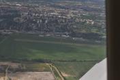
EPGL
Gliwice Airport
VFR Chart of EPGL
Sectional Charts at SkyVector.com
IFR Chart of EPGL
Enroute Charts at SkyVector.com
Location Information for EPGL
Coordinates: N50°16.17' / E18°40.37'View all Airports in Silesian, Poland.
Elevation is 833.0 feet MSL.
Operations Data
|
|
Nearby Navigation Aids
|
| ||||||||||||||||||||||||||||||||||||||||||||||||||||||||||||


Runway
| Surface: | Soft | |
|---|---|---|
Nearby Airports with Instrument Procedures
| ID | Name | Heading / Distance | ||
|---|---|---|---|---|
 |
EPKT | Katowice-Pyrzowice Airport | 051° | 19.9 |
|
LKMT | Ostrava/Mosnov Airport | 212° | 40.7 |
|
EPKK | Krakow-Balice Airport | 104° | 44.4 |
|
LZZI | Zilina Airport | 182° | 62.3 |
|
EPLK | Lask Airport | 013° | 79.4 |
|
EPWR | Wroclaw Strachowice Airport | 306° | 84.6 |
|
LKKU | Kunovice Airport | 213° | 88.6 |
|
EPLL | Lodz Airport | 017° | 91.5 |
|
LZTT | Poprad-Tatry Airport | 138° | 94.3 |
|
LKTB | Brno Turany Airport | 229° | 102.2 |
|
LZPP | Piestany Airport | 198° | 104.1 |
|
LKPD | Pardubice Airport | 263° | 114.3 |


Comments
Info is outdated
The data displayed here is outdated. In the summer of this year (2019) a new asphalt runway was built right next to the old grass one.
Pages