Login
Register


VYKI
Kanti Airport
VFR Chart of VYKI
Sectional Charts at SkyVector.com
IFR Chart of VYKI
Enroute Charts at SkyVector.com
Location Information for VYKI
Coordinates: N25°59.32' / E95°40.48'View all Airports in Sagaing, Myanmar.
Elevation is 672.0 feet MSL.
Operations Data
|
|
Airport Communications
| KANTI Approach: | 119.70 |
|---|---|
| KANTI Tower: | 118.70 |
Nearby Navigation Aids
|
| ||||||||||||||||||||||||||||||||||||||||||||||||||||||||||||


Runway 03/21
| Dimensions: | 6001 x 98 feet / 1829 x 30 meters | |
|---|---|---|
| Surface: | Hard | |
| Runway 03 | Runway 21 | |
| Coordinates: | N25°58.93' / E95°40.18' | N25°59.69' / E95°40.76' |
| Elevation: | 669 | 673 |
| Runway Heading: | 035° | 215° |
| Displaced Threshold: | 400 Feet | |
Nearby Airports with Instrument Procedures
| ID | Name | Heading / Distance | ||
|---|---|---|---|---|
 |
VYHL | Hommalinn Airport | 212° | 77.2 |
|
VEJT | Jorhat Airport | 299° | 92.2 |
|
VEMN | Dibrugarh Airport | 338° | 96.1 |
|
VYMK | Myitkyina Airport | 111° | 97.9 |
|
VEMR | Dimapur Airport | 266° | 103.1 |
|
VELR | Lilabari Airport | 312° | 115.3 |
|
VEIM | Imphal Airport | 233° | 121.1 |
|
VYPT | Putao Airport | 049° | 123.7 |
|
VYBM | Banmaw Airport | 139° | 133.8 |
|
VEKU | Silchar Airport | 246° | 159.9 |
|
ZPMS | Dehong/Mangshi Airport | 120° | 182.3 |
Airport Images
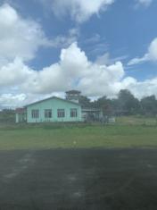
By: James Shwe


