Login
Register
SAWH
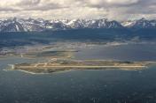
Ushuaia/Malvinas Argentinas Airport
VFR Chart of SAWH
Sectional Charts at SkyVector.com
IFR Chart of SAWH
Enroute Charts at SkyVector.com
Location Information for SAWH
Coordinates: S54°50.60' / W68°17.73'View all Airports in Tierra del Fuego, Argentina.
Elevation is 96.0 feet MSL.
Operations Data
|
|
Airport Communications
| USHUAIA TORRE Approach: | 118.10 |
|---|---|
| USHUAIA TORRE Approach: | 122.10 |
| ATIS USHUAIA ATIS: | 127.80 |
| USHUAIA/MALVINAS ARGENTIN Emergency: | 121.50 |
| USHUAIA TORRE Tower: | 118.10 |
| USHUAIA TORRE Tower: | 122.10 |
Nearby Navigation Aids
|
| ||||||||||||||||||||||||||||||||||||
Runway 07/25
| Dimensions: | 9199 x 148 feet / 2804 x 45 meters | |
|---|---|---|
| Surface: | Hard | |
| Runway 07 | Runway 25 | |
| Coordinates: | S54°50.64' / W68°18.88' | S54°50.55' / W68°16.59' |
| Elevation: | 82 | 69 |
| Runway Heading: | 074° | 254° |
| Displaced Threshold: | 591 Feet | 531 Feet |
Nearby Airports with Instrument Procedures
| ID | Name | Heading / Distance | ||
|---|---|---|---|---|
 |
SCGZ | Guardiamarina Zanartu Airport | 103° | 23.8 |
 |
SAWE | Rio Grande Airport | 016° | 66.9 |
 |
SCFM | Capitan Fuentes Martinez Airport | 322° | 119.4 |
 |
SCCI | Pdte. Carlos Ibanez Del Campo Airport | 319° | 143.0 |


