Login
Register
LPAZ
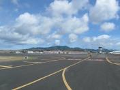
Santa Maria Airport
VFR Chart of LPAZ
Sectional Charts at SkyVector.com
IFR Chart of LPAZ
Enroute Charts at SkyVector.com
Location Information for LPAZ
Coordinates: N36°58.43' / W25°10.27'View all Airports in Azores, Portugal.
Elevation is 308.0 feet MSL.
Operations Data
|
|
Airport Communications
| PONTA DELGADA APPROACH Approach: | 119.40 |
|---|---|
| SANTA MARIA TOWER Emergency: | 121.50 |
| SANTA MARIA TOWER Tower: | 118.10 |
| SANTA MARIA TOWER Tower: | 119.10 |
Nearby Navigation Aids
|
| ||||||||||||||||||||||||||||||||||||
Runway 18/36
| Dimensions: | 10000 x 197 feet / 3048 x 60 meters | |
|---|---|---|
| Surface: | Hard | |
| Runway 18 | Runway 36 | |
| Coordinates: | N36°59.15' / W25°10.40' | N36°57.51' / W25°10.08' |
| Elevation: | 282 | 282 |
| Runway Heading: | 178° | 358° |
Nearby Airports with Instrument Procedures
| ID | Name | Heading / Distance | ||
|---|---|---|---|---|
 |
LPPD | Ponta Delgada - Joao Paulo II Airport | 331° | 52.5 |
 |
LPLA | Lajes Airport | 320° | 140.7 |


