Login
Register
LUKK
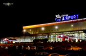
Chisinau International Airport
VFR Chart of LUKK
Sectional Charts at SkyVector.com
IFR Chart of LUKK
Enroute Charts at SkyVector.com
Location Information for LUKK
Coordinates: N46°55.67' / E28°55.85'View all Airports in Chisinau, Moldova.
Elevation is 399.0 feet MSL.
Operations Data
|
|
Airport Communications
| CHISINAU APPROACH Approach: | 129.72 |
|---|---|
| CHISINAU APPROACH Approach: | 133.30 |
| CHISINAU ATIS ATIS: | 125.22 |
| CHISINAU Emergency: | 121.50 |
| CHISINAU TOWER Ground Control: | 121.80 |
| CHISINAU GROUND Ground Control: | 129.72 |
| CHISINAU APRON Ramp/Taxi Control: | 131.70 |
| CHISINAU TOWER Tower: | 118.10 |
| CHISINAU TOWER Tower: | 129.72 |
Nearby Navigation Aids
|
| ||||||||||||||||||||||||||||||||||||||||||||||||||||||||||||
Runway 08/26
| Dimensions: | 11778 x 148 feet / 3590 x 45 meters | |
|---|---|---|
| Surface: | Hard | |
| Runway 08 | Runway 26 | |
| Coordinates: | N46°55.64' / E28°54.44' | N46°55.70' / E28°57.27' |
| Elevation: | 399 | 280 |
| Runway Heading: | 081° | 261° |
Runway 09/27
| Dimensions: | 7818 x 148 feet / 2383 x 45 meters | |
|---|---|---|
| Surface: | Unknown | |
| Runway 09 | Runway 27 | |
| Coordinates: | N46°55.96' / E28°55.21' | N46°55.80' / E28°57.08' |
| Elevation: | 359 | 286 |
| Runway Heading: | 090° | 270° |
Nearby Airports with Instrument Procedures
| ID | Name | Heading / Distance | ||
|---|---|---|---|---|
 |
UKOM | Lymans'Ke International Airport | 108° | 47.2 |
 |
LRIA | Iasi Airport | 286° | 55.8 |
 |
LUBM | Marculesti International Airport | 332° | 63.3 |
 |
UKOO | Odesa International Airport | 112° | 78.0 |
 |
LRBC | George Enescu Airport | 254° | 86.9 |
 |
LRTC | Tulcea/Delta Dunarii Airport | 184° | 112.3 |
 |
LRSV | Stefan Cel Mare Airport | 294° | 114.6 |
 |
UKON | Mykolaiv International. Airport | 085° | 123.0 |
 |
UKLN | Chernivtsi Airport | 304° | 144.0 |


