Login
Register
JWY
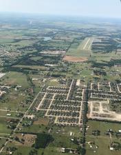
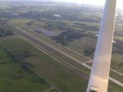
Mid-Way Regional Airport
Official FAA Data Effective 2025-01-23 0901Z
VFR Chart of KJWY
Sectional Charts at SkyVector.com
IFR Chart of KJWY
Enroute Charts at SkyVector.com
Location Information for KJWY
Coordinates: N32°27.50' / W96°54.75'Located 05 miles SE of Midlothian/Waxahachie, Texas on 243 acres of land. View all Airports in Texas.
Estimated Elevation is 727 feet MSL.
Operations Data
|
|
Airport Communications
| AWOS-3P: | 119.575 Tel. 972-227-0471 |
|---|---|
| LONE STAR APPROACH: | 125.2 343.65 |
| LONE STAR DEPARTURE: | 125.2 343.65 |
| GARLAND DP: | 125.2 343.65 |
| FINGR STAR: | 124.3 125.275 282.275 308.4 |
| YEAGR STAR: | 125.025 125.275 308.4 |
| CTAF: | 122.975 |
| UNICOM: | 122.975 |
| SWVAY STAR: | 135.975 379.9 |
| GREGS STAR: | 118.1 306.95 |
| REEKO STAR: | 125.2 343.65 |
| JFRYE STAR: | 118.1 306.95 |
| SLANT STAR: | 125.275 308.4 |
| DODJE STAR: | 125.2 125.9 343.65 |
| AWOS-3PT at LNC (12.2 NE): | 118.975 972-227-0471 |
| ASOS at RBD (13.4 N): | 214-330-5317 |
| ATIS at RBD (13.6 N): | 126.35 |
Nearby Navigation Aids
|
| ||||||||||||||||||||||||||||||||||||||||||||||||||||||||||||
Runway 18/36
| Dimensions: | 6500 x 100 feet / 1981 x 30 meters | |
|---|---|---|
| Surface: | Asphalt in Good Condition | |
| Weight Limits: | S-30, D-90 | |
| Edge Lighting: | Medium Intensity | |
| Runway 18 | Runway 36 | |
| Coordinates: | N32°28.03' / W96°54.71' | N32°26.96' / W96°54.80' |
| Elevation: | 727.0 | 686.3 |
| Runway Heading: | 184° True | 4° True |
| Markings: | Precision Instrument in fair condition. | Non-Precision Instrument in good condition. |
| Glide Slope Indicator | P4R (3.00° Glide Path Angle) | P4L (3.00° Glide Path Angle) |
| REIL: | Yes | |
Services Available
| Fuel: | 100LL (blue), Jet-A |
|---|---|
| Transient Storage: | Tiedowns |
| Airframe Repair: | MAJOR |
| Engine Repair: | MAJOR |
| Bottled Oxygen: | NOT AVAILABLE |
| Bulk Oxygen: | NOT AVAILABLE |
| Other Services: | AVIONICS,GLIDER SERVICE,PILOT INSTRUCTION,AIRCRAFT SALES,ANNUAL SURVEYING,GLIDER TOWING SERVICES |
Ownership Information
| Ownership: | Publicly owned | |
|---|---|---|
| Owner: | MIDLOTHIAN & WAXAHACHIE CITY | |
| PO BOX 757 | ||
| WAXAHACHIE, TX 75150 | ||
| (469) 309-4000 | WAXAHACHIE CITY HALL. | |
| Manager: | SHARLETTE WRIGHT | |
| 131 AIRPORT DRIVE, STE 101 | ||
| MIDLOTHIAN, TX 76065 | ||
| 972-923-0080 | ||
Other Remarks
- GLIDER OPNS ON ARPT.
- FOR CD CTC REGIONAL APCH AT 972-615-2799.
- 0LL FOR FUEL & SVCS AFT HRS CALL 214-762-8286 OR 972-979-5723.
- ACTVT REIL RWY 18; MIRL RWY 18/36 - CTAF. PAPI RWY 18 & 36 OPR CONSLY.
Weather Minimums
Standard Terminal Arrival (STAR) Charts
Instrument Approach Procedure (IAP) Charts
Departure Procedure (DP) Charts
Nearby Airports with Instrument Procedures
| ID | Name | Heading / Distance | ||
|---|---|---|---|---|
 |
KLNC | Lancaster Regional Airport | 054° | 12.2 |
 |
KRBD | Dallas Exec Airport | 009° | 13.5 |
 |
F41 | Ennis Municipal Airport | 121° | 14.8 |
 |
KGKY | Arlington Municipal Airport | 323° | 15.4 |
 |
KGPM | Grand Prairie Municipal Airport | 334° | 15.9 |
 |
KFWS | Fort Worth Spinks Airport | 287° | 21.1 |
 |
KDAL | Dallas Love Field Airport | 007° | 23.4 |
 |
KINJ | Hillsboro Municipal Airport | 202° | 24.3 |
 |
KHQZ | Mesquite Metro Airport | 048° | 26.0 |
 |
KDFW | Dallas-Fort Worth International Airport | 346° | 27.0 |
 |
KCPT | Cleburne Regional Airport | 256° | 27.2 |
 |
KADS | Addison Airport | 007° | 30.8 |


