Login
Register
LEBZ
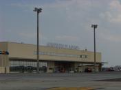
Badajoz/Talavera La Real Airport
VFR Chart of LEBZ
Sectional Charts at SkyVector.com
IFR Chart of LEBZ
Enroute Charts at SkyVector.com
Location Information for LEBZ
Coordinates: N38°53.48' / W6°49.28'View all Airports in Extremadura, Spain.
Elevation is 608.0 feet MSL.
Operations Data
|
|
Airport Communications
| TALAVERA APP Approach: | 120.55 |
|---|---|
| TALAVERA APP Approach: | 139.30 |
| TALAVERA APP Approach: | 363.55 |
| TALAVERA LA REAL Emergency: | 121.50 |
| TALAVERA LA REAL Emergency: | 243.00 |
| BADAJOZ GMC Ground Control: | 130.15 |
| BADAJOZ TWR Tower: | 122.10 |
| BADAJOZ TWR Tower: | 139.30 |
| BADAJOZ TWR Tower: | 257.80 |
| BADAJOZ TWR Tower: | 313.60 |
Nearby Navigation Aids
|
| ||||||||||||||||||||||||||||||||||||||||||||||||||||||||||||
Runway 13/31
| Dimensions: | 9357 x 197 feet / 2852 x 60 meters | |
|---|---|---|
| Surface: | Hard | |
| Runway 13 | Runway 31 | |
| Coordinates: | N38°53.93' / W6°50.08' | N38°53.03' / W6°48.47' |
| Elevation: | 578 | 608 |
| Runway Heading: | 128° | 308° |
Nearby Airports with Instrument Procedures
| ID | Name | Heading / Distance | ||
|---|---|---|---|---|
 |
LPEV | Evora Airport | 247° | 54.8 |
 |
LPSO | Ponte De Sor Airport | 288° | 60.9 |
 |
LPBJ | Beja Airport | 227° | 71.5 |
 |
LEZL | Sevilla Airport | 153° | 98.5 |
 |
LPAR | Alverca Airport | 270° | 103.4 |
 |
LPMT | Montijo Airport | 264° | 104.5 |
 |
LPPT | Lisboa/ Humberto Delgado Airport | 267° | 108.7 |
 |
LEMO | Moron Airport | 150° | 117.7 |
 |
LPCS | Cascais Airport | 266° | 119.3 |
 |
LPFR | Faro Airport | 206° | 124.9 |


Comments
LEBZ - Talavera la Real Airport
Hello
She wanted to clear up a mistake. The Spanish LEBZ - Talavera la Real (Badajoz) airport is a civil and military airport. It is not only military as you have noted NMR Sky Vector.
This information can be consulted by visiting the official website of the Spanish AIP.
https://aip.enaire.es/AIP/content_AIP/AD/AD2/LEBZ/LE_AD_2_LEBZ_en.pdf