Login
Register
LOIH
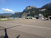
Hohenems Dornbirn Airport
VFR Chart of LOIH
Sectional Charts at SkyVector.com
IFR Chart of LOIH
Enroute Charts at SkyVector.com
Location Information for LOIH
Coordinates: N47°23.07' / E9°41.98'View all Airports in Vorarlberg, Austria.
Elevation is 1352.0 feet MSL.
Operations Data
|
|
Nearby Navigation Aids
|
| ||||||||||||||||||||||||||||||||||||||||||||||||||||||||||||
Runway
| Surface: | Hard | |
|---|---|---|
Nearby Airports with Instrument Procedures
| ID | Name | Heading / Distance | ||
|---|---|---|---|---|
 |
LSZR | St Gallen Altenrhein Airport | 317° | 8.2 |
 |
EDNY | Friedrichshafen Airport | 336° | 18.8 |
 |
EDTM | Mengen-Hohentengen Airport | 341° | 42.3 |
 |
EDJA | Memmingen Airport | 030° | 42.4 |
 |
LSZH | Zurich Airport | 275° | 47.1 |
 |
ETHL | Laupheim Airport | 009° | 50.9 |
 |
EDTD | Donaueschingen Airport | 306° | 59.4 |
 |
ETSA | Landsberg/Lech Airport | 049° | 63.9 |
 |
ETSL | Lechfeld Airport | 043° | 67.2 |
 |
LOWI | Innsbruck Airport | 095° | 67.5 |
 |
EDMO | Oberpfaffenhofen Airport | 056° | 76.6 |
 |
EDSE | Goppingen-Bezgenriet Airport | 357° | 76.5 |


Comments
LOIH
Hard surface
http://www.loih.at/