Login
Register


LSPV
Wangen-Lachen Airport
VFR Chart of LSPV
Sectional Charts at SkyVector.com
IFR Chart of LSPV
Enroute Charts at SkyVector.com
Location Information for LSPV
Coordinates: N47°12.28' / E8°52.05'View all Airports in Schwyz, Switzerland.
Elevation is 1335.0 feet MSL.
Operations Data
|
|
Nearby Navigation Aids
|
| ||||||||||||||||||||||||||||||||||||||||||||||||||||||||||||


Runway 08/26
| Dimensions: | 1640 x 59 feet / 500 x 18 meters | |
|---|---|---|
| Surface: | Hard | |
| Runway 08 | Runway 26 | |
| Coordinates: | N47°12.26' / E8°51.86' | N47°12.31' / E8°52.24' |
| Elevation: | 1335 | 1335 |
| Runway Heading: | 076° | 256° |
Nearby Airports with Instrument Procedures
| ID | Name | Heading / Distance | ||
|---|---|---|---|---|
 |
LSZH | Zurich Airport | 319° | 20.0 |
|
LSZR | St Gallen Altenrhein Airport | 059° | 33.0 |
|
EDNY | Friedrichshafen Airport | 042° | 38.4 |
|
EDTD | Donaueschingen Airport | 343° | 48.2 |
|
EDTM | Mengen-Hohentengen Airport | 021° | 54.9 |
|
LSZB | Bern Belp Airport | 253° | 58.8 |
|
LFSB | Bale-Mulhouse Airport | 293° | 59.3 |
|
LSZG | Grenchen Airport | 269° | 59.4 |
|
LSZA | Lugano Airport | 178° | 72.1 |
|
EDJA | Memmingen Airport | 049° | 72.9 |
|
ETHL | Laupheim Airport | 034° | 74.2 |
|
EDTL | Lahr Airport | 329° | 81.6 |
Airport Images
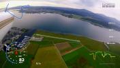
By: Matthias79


