Login
Register
TX40
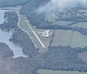
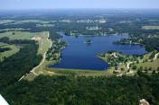
Echo Lake Airport
Official FAA Data Effective 2025-12-25 0901Z
VFR Chart of TX40
Sectional Charts at SkyVector.com
IFR Chart of TX40
Enroute Charts at SkyVector.com
Location Information for TX40
Coordinates: N32°15.21' / W95°39.33'Located 03 miles SW of Brownsboro, Texas. View all Airports in Texas.
Estimated Elevation is 465 feet MSL.
Operations Data
|
|
Airport Communications
| AWOS-3PT at F44 (10.3 SW): | 119.6 903-670-1247 |
|---|---|
| ATIS at TYR (14.2 NE): | 126.25 |
| ASOS at TYR (14.2 NE): | 903-535-9105 |
Nearby Navigation Aids
|
| ||||||||||||||||||||||||||||||||||||||||||||||||||||||||||||
Runway 16/34
| Dimensions: | 2600 x 40 feet / 792 x 12 meters | |
|---|---|---|
| Surface: | Asphalt | |
| Runway 16 | Runway 34 | |
| Coordinates: | N32°15.42' / W95°39.39' | N32°15.00' / W95°39.27' |
| Elevation: | 465.0 | 440.0 |
| Traffic Pattern: | Right | |
| Runway Heading: | 166° True | 346° True |
| Obstacles: | 30 ft Trees 400 ft from runway | 30 ft Trees 400 ft from runway |
Services Available
| Fuel: | NONE |
|---|---|
| Transient Storage: | NONE |
| Airframe Repair: | NONE |
| Engine Repair: | NONE |
| Bottled Oxygen: | NOT AVAILABLE |
| Bulk Oxygen: | NOT AVAILABLE |
Ownership Information
| Ownership: | Privately Owned | |
|---|---|---|
| Owner: | ECHO LAKE PROPERTY OWNERS ASSN | |
| PO BOX 278 | ||
| BROWNSBORO, TX 75756 | ||
| Manager: | ECHO LAKE AIRFIELD COMMITTEE | |
| PO BOX 278 | ||
| MURCHINSON, TX 75778 | ||
| 903-231-3480 | ||
Other Remarks
- SIGNED LIABILITY REQUIRED PRIOR TO LNDG OBTAIN WAIVER AT WWW.ECHOLAKEPILOTS.ORG.
- TOWERS LCTD BTN 1.5 NM & 2.9 NM N, NW, NE AND SE OF ARPT.
- WILDLIFE ON RY & INVOF ARPT.
- DO NOT FLY OVER THE LAKE.
- FOR CD CTC FORT WORTH ARTCC AT 817-858-7584.
Nearby Airports with Instrument Procedures
| ID | Name | Heading / Distance | ||
|---|---|---|---|---|
 |
F44 | Athens Municipal Airport | 238° | 10.3 |
 |
KTYR | Tyler Pounds Regional Airport | 064° | 14.2 |
 |
KPSN | Palestine Municipal Airport | 185° | 28.5 |
 |
KJDD | Wood County/Collins Field Airport | 015° | 30.4 |
 |
KJSO | Cherokee County Airport | 135° | 32.1 |
 |
07F | Gladewater Municipal Airport | 064° | 38.5 |
 |
KCRS | C David Campbell Field-Corsicana Municipal Airport | 250° | 40.3 |
 |
KTRL | Terrell Municipal Airport | 311° | 41.3 |
 |
KRFI | Rusk County Airport | 099° | 41.5 |
 |
KJXI | Fox Stephens Field/Gilmer Municipal Airport | 053° | 44.7 |
 |
F51 | Winnsboro Municipal Airport | 024° | 45.3 |
 |
KGGG | East Texas Regional Airport | 080° | 48.6 |


