Login
Register
VA07
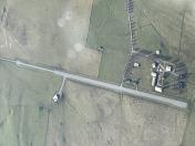
Burkes Garden Airport
Official FAA Data Effective 2026-01-22 0901Z
VFR Chart of VA07
Sectional Charts at SkyVector.com
IFR Chart of VA07
Enroute Charts at SkyVector.com
Location Information for VA07
Coordinates: N37°5.74' / W81°22.16'Located 12 miles SE of Tazewell, Virginia. View all Airports in Virginia.
Estimated Elevation is 3060 feet MSL.
Operations Data
|
|
Airport Communications
| AWOS-3 at MKJ (12.1 S): | 123.875 276-686-6420 |
|---|---|
| ASOS at BLF (14.5 NE): | 132.725 304-327-5766 |
| AWOS-3 at JFZ (20.6 W): | 118.075 276-596-9927 |
Nearby Navigation Aids
|
| ||||||||||||||||||||||||||||||||||||||||||||||||||||||||||||
Runway 06/24
| Dimensions: | 2500 x 50 feet / 762 x 15 meters | |
|---|---|---|
| Surface: | Asphalt | |
| Runway 06 | Runway 24 | |
Ownership Information
| Ownership: | Privately Owned | |
|---|---|---|
| Owner: | MOCOMP, INC | |
| PO BOX 920 | ||
| VERONA, VA 24482 | ||
| Manager: | PRESLEY WILLIAM MOORE III | |
| 401 COMMERCE ROAD, SUITE 403 | ||
| STAUNTON, VA 24401 | ||
| (540) 849-0366 | ||
Other Remarks
- FOR CD CTC ATLANTA ARTCC AT 770-210-7692.
Nearby Airports with Instrument Procedures
| ID | Name | Heading / Distance | ||
|---|---|---|---|---|
 |
KMKJ | Mountain Empire Airport | 175° | 12.1 |
 |
KBLF | Mercer County Airport | 032° | 14.3 |
 |
KJFZ | Tazewell County Airport | 264° | 20.7 |
 |
I16 | Kee Field Airport | 343° | 31.6 |
 |
KHLX | Twin County Airport | 126° | 32.9 |
 |
KPSK | New River Valley Airport | 085° | 33.2 |
 |
KGEV | Ashe County Airport | 183° | 39.8 |
 |
KVJI | Virginia Highlands Airport | 232° | 40.3 |
 |
KBKW | Raleigh County Memorial Airport | 015° | 43.1 |
 |
6A4 | Johnson County Airport | 208° | 46.2 |
 |
KBCB | Virginia Tech/Montgomery Exec Airport | 081° | 46.4 |
 |
KEBD | Southern West Virginia Regional Airport | 314° | 50.3 |


