Login
Register
VA49
Lynnhaven Field Airport
Official FAA Data Effective 2026-01-22 0901Z
VFR Chart of VA49
Sectional Charts at SkyVector.com
IFR Chart of VA49
Enroute Charts at SkyVector.com
Location Information for VA49
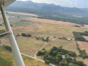
Coordinates: N38°19.87' / W78°45.27'Located 03 miles SSW of Mcgaheysville, Virginia on 40 acres of land. View all Airports in Virginia.
Estimated Elevation is 1100 feet MSL.
Operations Data
|
|
Airport Communications
| AWOS-3 at SHD (8.1 SW): | 124.925 540-234-0110 |
|---|---|
| AWOS-3 at VBW (9.9 W): | 119.55 540-828-2076 |
| AWOS-3PT at W13 (17.6 SW): | 118.625 540-941-7570 |
Nearby Navigation Aids
|
| ||||||||||||||||||||||||||||||||||||||||||||||||||||||||||||
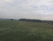
Runway 05/23
| Dimensions: | 1400 x 50 feet / 427 x 15 meters | |
|---|---|---|
| Surface: | Turf in Fair Condition | |
| Edge Lighting: | Non-Standard NO LGT EXISTS. | |
| Runway 05 | Runway 23 | |
Ownership Information
| Ownership: | Privately Owned | |
|---|---|---|
| Owner: | JEFFREY A. LUCATORTO | |
| 10306 DAIRY RD | ||
| MCGAHEYSVILLE, VA 22840 | ||
| Manager: | JEFFREY A. LUCATORTO | |
| 10306 DAIRY RD | ||
| MCGAHEYSVILLE, VA 22840 | ||
Other Remarks
- FOR CD CTC WASHINGTON ARTCC AT 703-771-3587.
- NO BCN EXISTS.
Nearby Airports with Instrument Procedures
| ID | Name | Heading / Distance | ||
|---|---|---|---|---|
 |
KSHD | Shenandoah Valley Regional Airport | 239° | 7.8 |
 |
KVBW | Bridgewater Air Park Airport | 282° | 9.9 |
 |
W13 | Eagle's Nest Airport | 210° | 17.7 |
 |
KCHO | Charlottesville-Albemarle Airport | 128° | 18.3 |
 |
8W2 | New Market Airport | 006° | 19.6 |
 |
KLUA | Luray Caverns Airport | 030° | 23.4 |
 |
KGVE | Gordonsville Municipal Airport | 110° | 29.7 |
 |
KOMH | Orange County Airport | 098° | 33.9 |
 |
KLKU | Louisa County/Freeman Field Airport | 117° | 41.8 |
 |
KFRR | Front Royal-Warren County Airport | 033° | 42.3 |
 |
KCJR | Culpeper Regional Airport | 074° | 43.8 |
 |
W99 | Grant County Airport | 335° | 43.8 |


