Login
Register


08A
Wetumpka Municipal Airport
Official FAA Data Effective 2026-01-22 0901Z
Chart Supplement

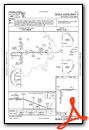
VFR Chart of 08A
Sectional Charts at SkyVector.com
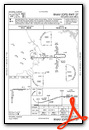
IFR Chart of 08A
Enroute Charts at SkyVector.com
Location Information for 08A
Coordinates: N32°31.64' / W86°19.86'Located 06 miles W of Wetumpka, Alabama on 312 acres of land. View all Airports in Alabama.
Surveyed Elevation is 197 feet MSL.
Operations Data
|
|
Airport Communications
| MONTGOMERY APPROACH: | 121.2 269.05 |
|---|---|
| MONTGOMERY DEPARTURE: | 121.2 269.05 |
| UNICOM: | 123.050 |
| CTAF: | 123.050 |
| ATIS at MXF (8.8 S): | 269.9 |
| AWOS-3P at 1A9 (10.5 SW): | 118.025 334-358-0919 |
| ATIS at MGM (14.0 S): | 120.675 |
- APCH/DEP SVC PRVDD BY ATLANTA ARTCC ON FREQS 120.45/298.850 (COLUMBUS RCAG) WHEN MONTGOMERY APCH CTL CLSD.
Nearby Navigation Aids
|
| ||||||||||||||||||||||||||||||||||||||||||||||||||||||||||||


Runway 09/27
| Dimensions: | 3013 x 80 feet / 918 x 24 meters | |
|---|---|---|
| Surface: | Asphalt in Poor Condition RWY CRACKING | |
| Weight Limits: | S-15 | |
| Edge Lighting: | Medium Intensity | |
| Runway 09 | Runway 27 | |
| Coordinates: | N32°31.76' / W86°19.99' | N32°31.77' / W86°19.40' |
| Elevation: | 196.7 | 196.4 |
| Traffic Pattern: | Left | Left |
| Runway Heading: | 89° True | 269° True |
| Markings: | Non-Precision Instrument in fair condition. | Non-Precision Instrument in fair condition. |
| REIL: | Yes | Yes |
Runway 18/36
| Dimensions: | 2876 x 130 feet / 877 x 40 meters | |
|---|---|---|
| Surface: | Turf in Fair Condition | |
| Runway 18 | Runway 36 | |
| Coordinates: | N32°31.74' / W86°20.03' | N32°31.27' / W86°20.04' |
| Elevation: | 195.7 | 191.0 |
| Runway Heading: | 181° True | 1° True |
| Displaced Threshold: | 983 Feet | |
| Markings: | Basic in good condition. | Basic in good condition. |
| Obstacles: | 108 ft Trees 1547 ft from runway, 84 ft left of center | 111 ft Trees 1588 ft from runway, 32 ft left of center RWY 36 APCH RATIO 15:1 FM DSPLCD THR. |
Services Available
| Fuel: | 100LL (blue) |
|---|---|
| Transient Storage: | Tiedowns |
| Airframe Repair: | MAJOR |
| Engine Repair: | MAJOR |
| Bottled Oxygen: | NONE |
| Bulk Oxygen: | NONE |
| Other Services: | AVIONICS,PILOT INSTRUCTION,AIRCRAFT RENTAL |
Ownership Information
| Ownership: | Publicly owned | |
|---|---|---|
| Owner: | CITY OF WETUMPKA | |
| PO BOX 1180 | ||
| WETUMPKA, AL 36092 | ||
| 334-567-5147 | ||
| Manager: | LYNN WELDON | |
| 1285 HIGHWAY 14 | ||
| ELMORE, AL 36025 | ||
| 334-285-5843 | ||
Other Remarks
- FOR CD CTC MONTGOMERY APCH AT 334-284-4575. WHEN APCH CLSD FOR CD CTC ATLANTA ARTCC AT 770-210-7692.
- MKD WITH 36 INCH WHITE CONES.
- MKD WITH 36 INCH WHITE CONES.
- DUSK-DAWN. ACTVT MIRL RWY 09/27 - CTAF.
Weather Minimums

Instrument Approach Procedure (IAP) Charts
Nearby Airports with Instrument Procedures
| ID | Name | Heading / Distance | ||
|---|---|---|---|---|
 |
KMXF | Maxwell AFB Airport | 191° | 8.8 |
|
1A9 | Prattville/Grouby Field Airport | 240° | 10.6 |
|
KMGM | Montgomery Regional (Dannelly Field) Airport | 193° | 13.9 |
|
02A | Chilton County Airport | 323° | 24.0 |
|
KALX | Thomas C Russell Field Airport | 038° | 29.8 |
|
06A | Moton Field Municipal Airport | 096° | 33.3 |
|
07A | Franklin Field Airport | 129° | 34.1 |
|
KSEM | Craig Field Airport | 251° | 35.1 |
|
KSCD | Merkel Field Sylacauga Municipal Airport | 001° | 38.6 |
|
KTOI | Troy Municipal At N Kenneth Campbell Field Airport | 157° | 43.1 |
|
KPRN | Mac Crenshaw Memorial Airport | 199° | 43.2 |
|
KEET | Shelby County Airport | 329° | 45.2 |
Airport Images
Do you have a recent image of this airport? Upload it here!


