Login
Register


2K4
Scott Field Airport
Official FAA Data Effective 2026-02-19 0901Z
Chart Supplement

VFR Chart of 2K4
Sectional Charts at SkyVector.com
IFR Chart of 2K4
Enroute Charts at SkyVector.com
Location Information for 2K4
Coordinates: N34°53.56' / W99°31.69'Located 02 miles NW of Mangum, Oklahoma on 151 acres of land. View all Airports in Oklahoma.
Surveyed Elevation is 1643 feet MSL.
Operations Data
|
|
Airport Communications
| ALTUS APPROACH: | 125.1 353.7 |
|---|---|
| ALTUS DEPARTURE: | 125.1 |
| CTAF: | 122.900 |
| AWOS-3PT at AXS (15.0 SE): | 118.825 580-477-1745 |
| ATIS at LTS (18.6 SE): | 109.8 |
| ASOS at HBR (24.2 E): | 133.325 580-726-6651 |
- APCH/DEP SVC PRVDD BY FORT WORTH ARTCC (ZFW) ON FREQS 128.4/269.375 (CLINTON-SHERMAN RCAG) WHEN ALTUS APCH CTL (LST) CLSD.
Nearby Navigation Aids
|
| ||||||||||||||||||||||||||||||||||||||||||


Runway 17/35
| Dimensions: | 4199 x 75 feet / 1280 x 23 meters | |
|---|---|---|
| Surface: | Asphalt in Fair Condition | |
| Weight Limits: | S-12 | |
| Edge Lighting: | Medium Intensity | |
| Runway 17 | Runway 35 | |
| Coordinates: | N34°53.90' / W99°31.69' | N34°53.21' / W99°31.69' |
| Elevation: | 1621.2 | 1643.8 |
| Traffic Pattern: | Left | Left |
| Runway Heading: | 180° True | 0 |
| Markings: | Non-Precision Instrument in good condition. | Non-Precision Instrument in good condition. |
| Obstacles: | 23 ft Trees 474 ft from runway | |
Services Available
| Fuel: | 100LL (blue) |
|---|---|
| Transient Storage: | Tiedowns |
| Airframe Repair: | MAJOR |
| Engine Repair: | MAJOR |
| Bottled Oxygen: | NONE |
| Bulk Oxygen: | NONE |
Ownership Information
| Ownership: | Publicly owned | |
|---|---|---|
| Owner: | CITY OF MANGUM | |
| CITY HALL, 201 N. OKLAHOMA | ||
| MANGUM, OK 73554 | ||
| 580-782-2256 | ||
| Manager: | GORDON LAYMAN | ELEC DEPT MGR. |
| CITY HALL, 201 N. OKLAHOMA | ||
| MANGUM, OK 73554 | ||
| 580-782-2250 | ||
Other Remarks
- PHONE 580-782-3383 FOR RIDE TO TOWN.
- 30 FT PWR LN 500 FT EAST END RWY 35.
- DRAINAGE DITCH ADJ RWY 17 75 FT WEST.
- ULTRALIGHTS ON AND INVOF ARPT.
- FOR CD CTC FORT WORTH ARTCC AT 817-858-7584.
- 0LL 24 HR AUTOMATED CREDIT CARD SYS.
Weather Minimums

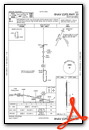
Instrument Approach Procedure (IAP) Charts

Nearby Airports with Instrument Procedures
| ID | Name | Heading / Distance | ||
|---|---|---|---|---|
 |
KAXS | Altus/Quartz Mountain Regional Airport | 141° | 14.9 |
|
KLTS | Altus AFB Airport | 136° | 18.6 |
|
O35 | Hollis Municipal Airport | 239° | 21.9 |
|
KHBR | Hobart Regional Airport | 075° | 24.2 |
|
KCSM | Clinton/Sherman Airport | 030° | 31.3 |
|
KELK | Elk City Regional Business Airport | 011° | 32.9 |
|
F05 | Wilbarger County Airport | 163° | 41.7 |
|
KFDR | Frederick Regional Airport | 140° | 42.1 |
|
KCDS | Childress Municipal Airport | 234° | 46.6 |
|
T59 | Wheeler Municipal Airport | 315° | 47.0 |
|
KCLK | Clinton Regional Airport | 036° | 48.5 |
|
KOJA | Weatherford Stafford Airport | 046° | 57.6 |
Airport Images
Do you have a recent image of this airport? Upload it here!


