Login
Register


60R
Navasota Municipal Airport
Official FAA Data Effective 2025-11-27 0901Z
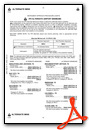
Chart Supplement

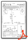
VFR Chart of 60R
Sectional Charts at SkyVector.com
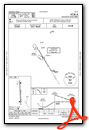
IFR Chart of 60R
Enroute Charts at SkyVector.com
Location Information for 60R
Coordinates: N30°22.03' / W96°6.78'Located 02 miles SW of Navasota, Texas on 85 acres of land. View all Airports in Texas.
Surveyed Elevation is 229 feet MSL.
Operations Data
|
|
Airport Communications
| AWOS-3PT: | 120.925 Tel. 936-825-0798 |
|---|---|
| HOUSTON APPROACH: | 134.3 360.85 |
| HOUSTON DEPARTURE: | 134.3 360.85 |
| CTAF: | 122.900 |
| AWOS-3 at 11R (16.2 SW): | 121.125 979-836-2303 |
| ATIS at CLL (18.5 NW): | 126.85 |
| ASOS at CLL (18.6 NW): | 979-846-1708 |
Nearby Navigation Aids
|
| ||||||||||||||||||||||||||||||||||||||||||||||||||||||||||||


Runway 17/35
| Dimensions: | 5003 x 75 feet / 1525 x 23 meters | |
|---|---|---|
| Surface: | Asphalt in Fair Condition | |
| Weight Limits: | S-30 | |
| Edge Lighting: | Medium Intensity | |
| Runway 17 | Runway 35 | |
| Coordinates: | N30°22.44' / W96°6.80' | N30°21.62' / W96°6.76' |
| Elevation: | 229.0 | 194.0 |
| Traffic Pattern: | Left | Left |
| Runway Heading: | 178° True | 358° True |
| Markings: | Non-Precision Instrument in fair condition. | Non-Precision Instrument in fair condition. |
| Glide Slope Indicator | P2L (3.00° Glide Path Angle) | P2L (3.00° Glide Path Angle) |
| REIL: | Yes | Yes |
| Obstacles: | 35 ft Tree 930 ft from runway, 263 ft left of center | 95 ft Trees 1930 ft from runway |
Services Available
| Fuel: | 100LL (blue), Jet-A |
|---|---|
| Transient Storage: | Tiedowns |
| Airframe Repair: | MAJOR |
| Engine Repair: | MAJOR |
| Bottled Oxygen: | NONE |
| Bulk Oxygen: | NONE |
Ownership Information
| Ownership: | Publicly owned | |
|---|---|---|
| Owner: | CITY OF NAVASOTA | |
| PO BOX 910 | ||
| NAVASOTA, TX 77868 | ||
| 936-825-6475 | ||
| Manager: | JENNIFER REYNA | |
| PO BOX 910 | ||
| NAVASOTA, TX 77868 | ||
| 936-825-6450 | ||
Other Remarks
- 16 FT MKD PWR LINE RWY 17, 1300 FT DSTC; 50 FT PWR LINE, 2500 FT DSTC.
- FOR CD CTC HOUSTON APCH AT 281-443-5844 TO CNL IFR CALL 281-443-5888.
- ACTVT PAPI RWY 17 & 35; MIRL RWY 17/35 - 123.3.
Weather Minimums

Instrument Approach Procedure (IAP) Charts

Nearby Airports with Instrument Procedures
| ID | Name | Heading / Distance | ||
|---|---|---|---|---|
 |
11R | Brenham Municipal Airport | 237° | 16.2 |
|
KCLL | Easterwood Field Airport | 315° | 18.5 |
|
KCFD | Coulter Field Airport | 331° | 23.7 |
|
KRWV | Caldwell Municipal Airport | 286° | 31.9 |
|
51R | Madisonville Municipal Airport | 014° | 33.7 |
|
KDWH | David Wayne Hooks Memorial Airport | 121° | 34.4 |
|
KUTS | Huntsville Municipal Airport | 050° | 35.5 |
|
KTME | Houston Exec Airport | 161° | 35.5 |
|
KCXO | Conroe/North Houston Regional Airport | 091° | 36.2 |
|
KIWS | West Houston Airport | 144° | 40.1 |
|
KLHB | Hearne Municipal Airport | 319° | 40.1 |
|
KIAH | George Bush Intcntl/Houston Airport | 119° | 46.2 |
Airport Images
Do you have a recent image of this airport? Upload it here!


