Login
Register
CXL
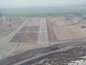
Calexico International Airport
Official FAA Data Effective 2026-02-19 0901Z
VFR Chart of KCXL
Sectional Charts at SkyVector.com
IFR Chart of KCXL
Enroute Charts at SkyVector.com
Location Information for KCXL
Coordinates: N32°40.05' / W115°31.05'Located 01 miles W of Calexico, California on 257 acres of land. View all Airports in California.
Estimated Elevation is 5 feet MSL.
TPA 800' CONVENTIONAL ACFT; 1200' JET ACFT.
Operations Data
|
|
Airport Communications
| UNICOM: | 122.800 |
|---|---|
| CTAF: | 122.800 |
| ASOS at IPL (10.5 N): | 132.175 760-355-2851 |
| ATIS at NJK (12.2 NW): | 269.275 |
| ASOS at NYL (46.0 E): |
- APCH/DEP SVC PRVDD BY YUMA CERAP (ZYL) ON FREQS 132.275/292.2 (EL CENTRO RCAG).
Nearby Navigation Aids
|
| ||||||||||||||||||||||||||||||||||||
Runway 08/26
| Dimensions: | 4683 x 75 feet / 1427 x 23 meters | |
|---|---|---|
| Surface: | Asphalt in Excellent Condition | |
| Weight Limits: | S-30 | |
| Edge Lighting: | Medium Intensity | |
| Runway 08 | Runway 26 | |
| Coordinates: | N32°40.05' / W115°31.51' | N32°40.04' / W115°30.60' |
| Elevation: | -0.8 | -5.6 |
| Traffic Pattern: | Left | Right |
| Runway Heading: | 91° True | 271° True |
| Displaced Threshold: | 160 Feet | |
| Markings: | Basic in good condition. | Basic in good condition. |
| Glide Slope Indicator | P4L (3.00° Glide Path Angle) | P4L (3.40° Glide Path Angle) |
| REIL: | Yes | Yes |
| Obstacles: | 37 ft Power Line 1000 ft from runway, 300 ft right of center | |
Services Available
| Fuel: | 100LL (blue), Jet-A, Jet A+ |
|---|---|
| Transient Storage: | Tiedowns |
| Airframe Repair: | NONE |
| Engine Repair: | NONE |
| Bottled Oxygen: | NONE |
| Bulk Oxygen: | NONE |
| Other Services: | CROP DUSTING SERVICES |
Ownership Information
| Ownership: | Publicly owned | |
|---|---|---|
| Owner: | CITY OF CALEXICO | |
| 608 HEBER AVENUE | ||
| CALEXICO, CA 92231 | ||
| (760) 768-2100 | ||
| Manager: | LILIANA FALOMIR | CITY MANAGER, OFFICE IN CALEXICO. |
| 608 HEBER AVENUE | ||
| CALEXICO, CA 92231 | ||
| (760) 768-2160 | ||
Other Remarks
- RY 08/26 - GROUND DROP-OFF ON EAST END OF RY & NORTH OF EAST ACFT PARKING AREA.
- FOR CD CTC YUMA CERAP AT 928-269-9569.
- UNICOM MONITORED 0800-1700.
- TPA 800' CONVENTIONAL ACFT; 1200' JET ACFT.
Nearby Airports with Instrument Procedures
| ID | Name | Heading / Distance | ||
|---|---|---|---|---|
 |
KIPL | Imperial County Airport | 342° | 10.5 |
 |
KBWC | Brawley Municipal Airport | 000° | 19.5 |
 |
KCLR | Cliff Hatfield Memorial Airport | 359° | 27.8 |
 |
KNYL | Yuma MCAS/Yuma International Airport | 090° | 46.2 |
 |
L08 | Borrego Valley Airport | 311° | 53.8 |
 |
KTRM | Jacqueline Cochran Regional Airport | 330° | 65.9 |
 |
KBLH | Blythe Airport | 035° | 69.8 |
 |
KRNM | Ramona Airport | 287° | 74.1 |
 |
KSEE | Gillespie Field Airport | 277° | 74.2 |
 |
KSDM | Brown Field Municipal Airport | 265° | 74.3 |
 |
KUDD | Bermuda Dunes Airport | 329° | 75.1 |
 |
KMYF | Montgomery-Gibbs Exec Airport | 276° | 82.6 |


