Login
Register


FOA
Flora Municipal Airport
Official FAA Data Effective 2025-12-25 0901Z
Chart Supplement

VFR Chart of KFOA
Sectional Charts at SkyVector.com
IFR Chart of KFOA
Enroute Charts at SkyVector.com
Location Information for KFOA
Coordinates: N38°39.90' / W88°27.19'Located 02 miles E of Flora, Illinois on 249 acres of land. View all Airports in Illinois.
Surveyed Elevation is 472 feet MSL.
Operations Data
|
|
Airport Communications
| AWOS-3: | 120.175 Tel. 618-662-8355 |
|---|---|
| CTAF: | 122.700 |
| UNICOM: | 122.700 |
| AWOS-3 at OLY (13.4 E): | 119.275 618-393-4416 |
| AWOS-3PT at FWC (17.3 S): | 119.425 618-847-4709 |
| AWOS-3PT at SLO (24.0 W): | 118.525 618-312-1051 |
- APCH/DEP SVC PRVDD BY KANSAS CITY ARTCC ON FREQS 127.7/351.825 (MOUNT VERNON RCAG)
Nearby Navigation Aids
|
| ||||||||||||||||||||||||||||||||||||||||||||||||||||||||||||


Runway 03/21
| Dimensions: | 5003 x 75 feet / 1525 x 23 meters | |
|---|---|---|
| Surface: | Asphalt in Fair Condition | |
| Weight Limits: | S-30, D-40 | |
| Edge Lighting: | Medium Intensity | |
| Runway 03 | Runway 21 | |
| Coordinates: | N38°39.50' / W88°27.43' | N38°40.21' / W88°26.91' |
| Elevation: | 472.5 | 466.1 |
| Traffic Pattern: | Left | Left |
| Runway Heading: | 30° True | 210° True |
| Markings: | Non-Precision Instrument in fair condition. | Non-Precision Instrument in fair condition. |
| Glide Slope Indicator | PSIL (3.00° Glide Path Angle) | PSIL (3.00° Glide Path Angle) |
| REIL: | Yes | |
| Obstacles: | 73 ft Tree 2708 ft from runway, 94 ft right of center | 46 ft Tree 1780 ft from runway, 62 ft left of center |
Runway 15/33
| Dimensions: | 2715 x 100 feet / 828 x 30 meters | |
|---|---|---|
| Surface: | Turf in Good Condition | |
| Runway 15 | Runway 33 | |
| Coordinates: | N38°40.18' / W88°27.37' | N38°39.79' / W88°27.08' |
| Elevation: | 472.2 | 465.2 |
| Traffic Pattern: | Left | Left |
| Runway Heading: | 150° True | 330° True |
| Displaced Threshold: | 204 Feet | 174 Feet |
| Obstacles: | 46 ft Tree 611 ft from runway APCH SLOPE 17:1 TO DSPLCD THR. |
27 ft Power Line 357 ft from runway, 160 ft right of center |
Services Available
| Fuel: | 100LL (blue), Jet-A |
|---|---|
| Transient Storage: | Hangars,Tiedowns |
| Airframe Repair: | NONE |
| Engine Repair: | NONE |
| Bottled Oxygen: | NONE |
| Bulk Oxygen: | NONE |
| Other Services: | AIRCRAFT RENTAL |
Ownership Information
| Ownership: | Publicly owned | |
|---|---|---|
| Owner: | FLORA AIRPORT AUTHORITY | |
| ONE AIRPORT ROAD | ||
| FLORA, IL 62839 | ||
| 618-662-2174 | ||
| Manager: | KAREN PICKEL | |
| ONE AIRPORT ROAD | ||
| FLORA, IL 62839 | ||
| 618-662-2823 | ||
Other Remarks
- RY 15/33 SOFT WHEN WET.
- FOR CD CTC KANSAS CITY ARTCC AT 913-254-8508.
- RWY 15 /33 THLDS & BOUNDARY OUTLINED BY WHITE 1/2 TIRES. DAY USE ONLY.
- 0LL FUEL SELF SVC WITH CREDIT CARD.
- MIRL RY 03/21 PRESET ON LOW INTST; TO INCR INTST & ACTVT REIL RY 21; PLASI RYS 03/21 & TWY LGTS - CTAF.
Weather Minimums
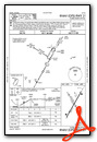
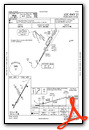
Instrument Approach Procedure (IAP) Charts

Nearby Airports with Instrument Procedures
| ID | Name | Heading / Distance | ||
|---|---|---|---|---|
 |
KOLY | Olney-Noble Airport | 075° | 13.4 |
|
KFWC | Fairfield Municipal Airport | 173° | 17.3 |
|
KSLO | Salem-Leckrone Airport | 267° | 24.1 |
|
1H2 | Effingham County Regional Airport | 351° | 24.6 |
|
KMVN | Mount Vernon Airport | 223° | 28.0 |
|
KENL | Centralia Municipal Airport | 253° | 31.3 |
|
KAJG | Mount Carmel Municipal Airport | 095° | 34.3 |
|
KCUL | Carmi Municipal Airport | 155° | 37.8 |
|
KVLA | Vandalia Municipal Airport | 300° | 38.7 |
|
KLWV | Lawrenceville-Vincennes International Airport | 081° | 40.2 |
|
KRSV | Crawford County Airport | 060° | 43.1 |
|
1H8 | Casey Municipal Airport | 028° | 43.6 |
Airport Images
Do you have a recent image of this airport? Upload it here!


