Login
Register


ENL
Centralia Municipal Airport
Official FAA Data Effective 2026-02-19 0901Z
Chart Supplement

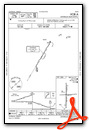
VFR Chart of KENL
Sectional Charts at SkyVector.com
IFR Chart of KENL
Enroute Charts at SkyVector.com
Location Information for KENL
Coordinates: N38°30.90' / W89°5.47'Located 02 miles SE of Centralia, Illinois on 314 acres of land. View all Airports in Illinois.
Estimated Elevation is 534 feet MSL.
Operations Data
|
|
Airport Communications
| AWOS-3PT: | 121.125 Tel. 618-533-4417 |
|---|---|
| CTAF: | 122.800 |
| UNICOM: | 122.800 |
| AWOS-3PT at SLO (9.7 NE): | 118.525 618-312-1051 |
| AWOS-3PT at MVN (15.9 SE): | 118.2 618-242-7933 |
| AWOS-2 at GRE (23.2 NW): | 120.0 618-664-1939 |
- APCH/DEP SVC PRVDD BY KANSAS CITY ARTCC ON FREQS 127.7/351.825 (MOUNT VERNON RCAG).
Nearby Navigation Aids
|
| ||||||||||||||||||||||||||||||||||||||||||||||||||||||||||||


Runway 18/36
| Dimensions: | 5001 x 75 feet / 1524 x 23 meters | |
|---|---|---|
| Surface: | Asphalt in Good Condition | |
| Weight Limits: | S-30, D-40 | |
| Edge Lighting: | Medium Intensity | |
| Runway 18 | Runway 36 | |
| Coordinates: | N38°31.30' / W89°5.50' | N38°30.48' / W89°5.51' |
| Elevation: | 519.3 | 534.1 |
| Traffic Pattern: | Left | Right |
| Runway Heading: | 181° True | 360° True |
| Markings: | Non-Precision Instrument in good condition. | Non-Precision Instrument in fair condition. |
| Glide Slope Indicator | P2L (3.00° Glide Path Angle) | P2L (3.00° Glide Path Angle) |
| REIL: | Yes | Yes |
| Obstacles: | 49 ft Tree 1608 ft from runway, 56 ft left of center | |
Runway 09/27
| Dimensions: | 3300 x 60 feet / 1006 x 18 meters | |
|---|---|---|
| Surface: | Asphalt in Good Condition | |
| Weight Limits: | S-12 | |
| Edge Lighting: | Medium Intensity | |
| Runway 09 | Runway 27 | |
| Coordinates: | N38°30.91' / W89°5.76' | N38°30.94' / W89°5.07' |
| Elevation: | 521.9 | 519.9 |
| Traffic Pattern: | Right | Left |
| Runway Heading: | 87° True | 267° True |
| Markings: | Basic in poor condition. | Basic in poor condition. |
| Obstacles: | 13 ft Road 470 ft from runway | |
Services Available
| Fuel: | 100LL (blue), Jet-A |
|---|---|
| Transient Storage: | Tiedowns |
| Airframe Repair: | NOT AVAILABLE |
| Engine Repair: | NOT AVAILABLE |
| Bottled Oxygen: | NONE |
| Bulk Oxygen: | NONE |
| Other Services: | CHARTER SERVICE,PILOT INSTRUCTION,AIRCRAFT RENTAL,AIRCRAFT SALES |
Ownership Information
| Ownership: | Publicly owned | |
|---|---|---|
| Owner: | CITY OF CENTRALIA | |
| 101 S. LOCUST | ||
| CENTRALIA, IL 62801 | ||
| (618) 533-7622 | ||
| Manager: | GALEN MAHLE | |
| 2331 E. CALUMET | EMAIL ADDRESS: GMAHLE@CITYOFCENTRALIA.ORG (ALL LOWER CASE) | |
| CENTRALIA, IL 62801 | ||
| 618-533-7622 | CELL # 618-267-7844 | |
Other Remarks
- FOR CD IF UNA TO CTC ON FSS FREQ, CTC KANSAS CITY ARTCC AT 913-254-8508.
- RWY 9 MARKING POOR.
- RWY 27 MARKINGS FADED.
- ACTVT MIRL RY 09/27, RY 18/36 & REIL RY 18/36 - CTAF.
Weather Minimums

Instrument Approach Procedure (IAP) Charts


Nearby Airports with Instrument Procedures
| ID | Name | Heading / Distance | ||
|---|---|---|---|---|
 |
KSLO | Salem-Leckrone Airport | 037° | 9.7 |
|
KMVN | Mount Vernon Airport | 136° | 15.9 |
|
KGRE | Greenville Airport | 325° | 23.5 |
|
KVLA | Vandalia Municipal Airport | 352° | 28.8 |
|
KFOA | Flora Municipal Airport | 073° | 31.3 |
|
H96 | Benton Municipal Airport | 166° | 31.3 |
|
KFWC | Fairfield Municipal Airport | 104° | 33.0 |
|
KPJY | Pinckneyville/Du Quoin Airport | 201° | 34.6 |
|
KBLV | Scott AFB/Midamerica St Louis Airport | 273° | 35.1 |
|
KSAR | Sparta Community-Hunter Field Airport | 232° | 36.1 |
|
1H2 | Effingham County Regional Airport | 037° | 42.3 |
|
KOLY | Olney-Noble Airport | 073° | 44.8 |
Airport Images
")
By: mkheck


