Login
Register
L51
Heller Farm Airport
Official FAA Data Effective 2026-01-22 0901Z
VFR Chart of L51
Sectional Charts at SkyVector.com
IFR Chart of L51
Enroute Charts at SkyVector.com
Location Information for L51
Coordinates: N47°43.58' / W108°52.50'Located 23 miles WSW of Winifred, Montana. View all Airports in Montana.
Estimated Elevation is 2304 feet MSL.
Operations Data
|
|
Airport Communications
| CTAF: | 122.900 |
|---|---|
| ASOS at LWT (47.2 SW): | 118.375 406-538-2653 |
| AWOS-3 at MVH (53.4 S): | 120.0 406-428-2103 |
| AWOS-AV at S71 (54.2 N): | 118.35 406-357-3453 |
Nearby Navigation Aids
|
| ||||||||||||||||||||||||
Runway 11/29
| Dimensions: | 2998 x 80 feet / 914 x 24 meters | |
|---|---|---|
| Surface: | Turf-Dirt in Good Condition | |
| Runway 11 | Runway 29 | |
| Obstacles: | CTLG OBSTN EXCEEDS A 45 DEG SLP. |
110 ft Hill 60 ft from runway, 90 ft left of center |
Services Available
| Fuel: | NONE |
|---|---|
| Transient Storage: | NONE |
| Airframe Repair: | NONE |
| Engine Repair: | NONE |
| Bottled Oxygen: | NONE |
| Bulk Oxygen: | NONE |
Ownership Information
| Ownership: | Privately Owned | |
|---|---|---|
| Owner: | LOREN SMITH | |
| 1500 51ST STREET SOUTH | ||
| GREAT FALLS, MT 59405 | ||
| 406-727-3192 | ||
| Manager: | LOREN SMITH | |
| 1500 51ST STREET SOUTH | ||
| GREAT FALLS, MT 59405 | ||
| 406-727-3192 | ||
Other Remarks
- DO NOT LAND IF WET
- LIVESTOCK & WILDLIFE POSSIBLE ON RUNWAY OR IN THE VICINITY
- FOR CD CTC SALT LAKE ARTCC AT 801-320-2568.
- MOWING IREG.
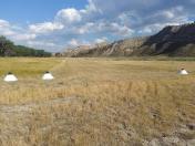
- CONES FOR 2400 FEET W/300 FEET OF OVERUN
- 2400 FEET MARKED WITH CONES 300 FEET AVAILABLE FOR OVERRUN
Nearby Airports with Instrument Procedures
| ID | Name | Heading / Distance | ||
|---|---|---|---|---|
 |
KLWT | Lewistown Municipal Airport | 210° | 47.3 |
 |
M75 | Malta Airport | 044° | 54.4 |
 |
KHVR | Havre City-County Airport | 324° | 60.6 |
 |
S64 | Stanford/Biggerstaff Field Airport | 238° | 65.2 |
 |
79S | Fort Benton Airport | 276° | 71.6 |
 |
KRPX | Roundup Airport | 169° | 76.3 |
 |
KHWQ | Wheatland County At Harlowton Airport | 207° | 86.5 |
 |
KGGW | Wokal Field/Glasgow-Valley County Airport | 071° | 95.7 |
 |
KGTF | Great Falls International Airport | 262° | 102.4 |
 |
7S6 | White Sulphur Springs Airport | 229° | 111.5 |
 |
KBIL | Billings Logan International Airport | 173° | 116.0 |
 |
6S0 | Big Timber At Howard Field Airport | 201° | 123.9 |


