



Login
Register
LFMN
Nice Cote D'Azur Airport
VFR Chart of LFMN
Sectional Charts at SkyVector.com
IFR Chart of LFMN
Enroute Charts at SkyVector.com
Location Information for LFMN
Coordinates: N43°39.92' / E7°12.90'View all Airports in Provence-Alpes-Côte d'Azur, France.
Elevation is 12.0 feet MSL.
Operations Data
|
|
Airport Communications
| NICE APPROACH Approach: | 120.65 |
|---|---|
| NICE TOWER Approach: | 123.15 |
| NICE APPROACH Approach: | 124.18 |
| NICE APPROACH Approach: | 125.58 |
| NICE APPROACH Approach: | 128.20 |
| NICE APPROACH Approach: | 130.83 |
| NICE APPROACH Approach: | 134.47 |
| NICE ATIS: | 129.60 |
| NICE ATIS: | 136.58 |
| NICE INFORMATION Information: | 120.85 |
| NICE INFORMATION Information: | 122.92 |
| NICE INFORMATION Information: | 124.42 |
| NICE TOWER Tower: | 118.70 |
| NICE TOWER Tower: | 121.70 |
| NICE TOWER Tower: | 121.78 |
| NICE TOWER Tower: | 122.38 |
Nearby Navigation Aids
|
| ||||||||||||||||||||||||||||||||||||||||||||||||||||||||||||


Runway 04R/22L
| Dimensions: | 9721 x 148 feet / 2963 x 45 meters | |
|---|---|---|
| Surface: | Hard | |
| Runway 04R | Runway 22L | |
| Coordinates: | N43°38.80' / E7°12.15' | N43°39.94' / E7°13.71' |
| Elevation: | 10 | 12 |
| Runway Heading: | 043° | 223° |
Runway 04L/22R
| Dimensions: | 8622 x 148 feet / 2628 x 45 meters | |
|---|---|---|
| Surface: | Unknown | |
| Runway 04L | Runway 22R | |
| Coordinates: | N43°39.14' / E7°12.29' | N43°40.09' / E7°13.59' |
| Elevation: | 11 | 10 |
| Runway Heading: | 043° | 223° |
| Displaced Threshold: | 295 Feet | 200 Feet |
Nearby Airports with Instrument Procedures
| ID | Name | Heading / Distance | ||
|---|---|---|---|---|
 |
LFMD | Cannes Mandelieu Airport | 237° | 13.4 |
|
LFMC | Le Luc Le Cannet Airport | 245° | 39.9 |
|
LFTZ | La Mole Airport | 229° | 42.3 |
|
LIMG | Albenga/Riviera Airport | 059° | 45.6 |
|
LIMZ | Cuneo/Levaldigi Airport | 018° | 55.8 |
|
LFTH | Hyeres Le Palyvestre Airport | 234° | 57.9 |
|
LFMQ | Le Castellet Airport | 248° | 67.2 |
|
LFMA | Aix Les Milles Airport | 263° | 81.1 |
|
LIMJ | Genova/Sestri Airport | 056° | 83.3 |
|
LFML | Marseille Provence Airport | 261° | 88.3 |
|
LFMY | Salon De Provence Airport | 268° | 91.9 |
|
LIMF | Torino/Caselle Airport | 011° | 94.1 |
Airport Images
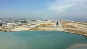
By: czyeager
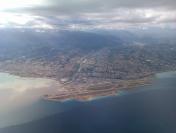
By: didiermarquet



Comments
ILS
Pourquoi ne trouve-t-on pas les Fréquences ILS pour les aéroports qui en sont pourvus?
ok
ok