Login
Register


LFTH
Hyeres Le Palyvestre Airport
VFR Chart of LFTH
Sectional Charts at SkyVector.com
IFR Chart of LFTH
Enroute Charts at SkyVector.com
Location Information for LFTH
Coordinates: N43°5.83' / E6°8.77'View all Airports in Provence-Alpes-Côte d'Azur, France.
Elevation is 13.0 feet MSL.
Operations Data
|
|
Airport Communications
| TOULON APPROACH Approach: | 118.82 |
|---|---|
| TOULON APPROACH Approach: | 122.50 |
| TOULON APPROACH Approach: | 126.32 |
| TOULON APPROACH Approach: | 339.25 |
| HYERES ATIS: | 129.65 |
| HYERES TOWER Emergency: | 121.50 |
| TOULON APPROACH Emergency: | 243.00 |
| TOULON RADAR Radar: | 125.20 |
| HYERES Tower: | 121.00 |
| HYERES Tower: | 121.80 |
| HYERES TOWER Tower: | 257.80 |
Nearby Navigation Aids
|
| ||||||||||||||||||||||||||||||||||||||||||||||||||||||||||||


Runway 05/23
| Dimensions: | 6959 x 148 feet / 2121 x 45 meters | |
|---|---|---|
| Surface: | Hard | |
| Runway 05 | Runway 23 | |
| Coordinates: | N43°5.74' / E6°8.59' | N43°6.37' / E6°9.66' |
| Elevation: | 6 | 6 |
| Runway Heading: | 049° | 229° |
| Displaced Threshold: | 889 Feet | |
Runway 13/31
| Dimensions: | 5935 x 148 feet / 1809 x 45 meters | |
|---|---|---|
| Surface: | Unknown | |
| Runway 13 | Runway 31 | |
| Coordinates: | N43°6.00' / E6°8.54' | N43°5.42' / E6°9.33' |
| Elevation: | 8 | 5 |
| Runway Heading: | 133° | 313° |
| Displaced Threshold: | 614 Feet | 358 Feet |
Nearby Airports with Instrument Procedures
| ID | Name | Heading / Distance | ||
|---|---|---|---|---|
 |
LFTZ | La Mole Airport | 066° | 16.1 |
|
LFMQ | Le Castellet Airport | 300° | 18.3 |
|
LFMC | Le Luc Le Cannet Airport | 031° | 20.2 |
|
LFMA | Aix Les Milles Airport | 305° | 42.0 |
|
LFMD | Cannes Mandelieu Airport | 052° | 44.5 |
|
LFML | Marseille Provence Airport | 296° | 45.6 |
|
LFMY | Salon De Provence Airport | 304° | 54.6 |
|
LFMN | Nice Cote D'Azur Airport | 053° | 57.9 |
|
LFMI | Istres-Le Tube Airport | 295° | 59.3 |
|
LFMV | Avignon Caumont Airport | 312° | 72.9 |
|
LFMO | Orange Caritat Airport | 318° | 83.7 |
|
LFTW | Nimes Garons Airport | 298° | 85.4 |
Airport Images
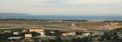
By: PH-EVD


