Login
Register
LGKV
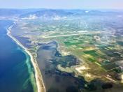
Megas Alexandros Airport
VFR Chart of LGKV
Sectional Charts at SkyVector.com
IFR Chart of LGKV
Enroute Charts at SkyVector.com
Location Information for LGKV
Coordinates: N40°54.83' / E24°37.18'View all Airports in Anatoliki Makedonia kai Thraki, Greece.
Elevation is 18.0 feet MSL.
Operations Data
|
|
Airport Communications
| KAVALA APPROACH Approach: | 122.10 |
|---|---|
| KAVALA APPROACH Approach: | 124.65 |
| KAVALA APPROACH Approach: | 257.80 |
| KAVALA MEGAS ALEXANDROS ATIS: | 128.15 |
| MEGAS ALEXANDROS TOWER Emergency: | 121.50 |
| MEGAS ALEXANDROS TOWER Emergency: | 243.00 |
| MEGAS ALEXANDROS RADIO Radio: | 5637.00 |
| MEGAS ALEXANDROS TOWER Tower: | 118.40 |
| MEGAS ALEXANDROS TOWER Tower: | 122.10 |
| MEGAS ALEXANDROS TOWER Tower: | 257.80 |
Nearby Navigation Aids
|
| ||||||||||||||||||||||||||||||||||||||||||||||||||||||||||||
Runway 05/23
| Dimensions: | 9843 x 148 feet / 3000 x 45 meters | |
|---|---|---|
| Surface: | Hard | |
| Runway 05 | Runway 23 | |
| Coordinates: | N40°54.38' / E24°36.30' | N40°55.30' / E24°38.06' |
| Elevation: | 11 | 18 |
| Runway Heading: | 050° | 230° |
Nearby Airports with Instrument Procedures
| ID | Name | Heading / Distance | ||
|---|---|---|---|---|
 |
LGAL | Dimokritos Airport | 092° | 60.9 |
 |
LGLM | Ifaistos Airport | 154° | 66.1 |
 |
LBPD | Plovdiv Airport | 008° | 70.0 |
 |
LTFK | Gokceada Airport | 126° | 71.9 |
 |
LGTS | Makedonia Airport | 253° | 78.8 |
 |
LTBH | Canakkale Airport | 118° | 94.9 |
 |
LGAX | Alexandria Airport | 261° | 98.4 |
 |
LGSK | Alexandros Papadiamandis Airport | 206° | 116.1 |
 |
LGSY | Skiros Airport | 183° | 116.9 |
 |
LBSF | Sofia Airport | 333° | 119.9 |
 |
LGBL | Nea Anchialos Airport | 220° | 131.9 |
 |
LGKZ | Filippos Airport | 254° | 132.4 |


