Login
Register
LOWS
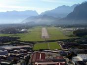
Salzburg Airport
VFR Chart of LOWS
Sectional Charts at SkyVector.com
IFR Chart of LOWS
Enroute Charts at SkyVector.com
Location Information for LOWS
Coordinates: N47°47.67' / E13°0.20'View all Airports in Salzburg, Austria.
Elevation is 1411.0 feet MSL.
Operations Data
|
|
Airport Communications
| SALZBURG RADAR Approach: | 123.72 |
|---|---|
| SALZBURG RADAR Approach: | 132.46 |
| SALZBURG INFORMATION ATIS: | 133.33 |
| SALZBURG DELIVERY Clearance Delivery: | 121.75 |
| SALZBURG Emergency: | 121.50 |
| SALZBURG TOWER Tower: | 118.10 |
Nearby Navigation Aids
|
| ||||||||||||||||||||||||||||||||||||||||||||||||||||||||||||
Runway 15/33
| Dimensions: | 9022 x 148 feet / 2750 x 45 meters | |
|---|---|---|
| Surface: | Hard | |
| Runway 15 | Runway 33 | |
| Coordinates: | N47°48.19' / E12°59.86' | N47°47.04' / E13°0.59' |
| Elevation: | 1411 | 1411 |
| Runway Heading: | 153° | 333° |
| Displaced Threshold: | 656 Feet | 787 Feet |
Nearby Airports with Instrument Procedures
| ID | Name | Heading / Distance | ||
|---|---|---|---|---|
 |
LOIJ | St Johann/Tirol Airport | 234° | 27.8 |
 |
LOWL | Linz Airport | 060° | 54.6 |
 |
EDDM | Muenchen Airport | 304° | 59.4 |
 |
EDMS | Straubing Wallmuhle Airport | 343° | 69.2 |
 |
EDMO | Oberpfaffenhofen Airport | 284° | 71.5 |
 |
LOWI | Innsbruck Airport | 245° | 74.7 |
 |
LOXZ | Zeltweg Airport | 115° | 79.3 |
 |
ETSI | Ingolstadt/Manching Airport | 313° | 80.8 |
 |
ETSA | Landsberg/Lech Airport | 281° | 86.2 |
 |
LOWK | Klagenfurt Airport | 141° | 88.1 |
 |
ETSL | Lechfeld Airport | 286° | 89.5 |
 |
ETSN | Neuburg Airport | 308° | 90.5 |


