Login
Register


MDO
Middleton Island Airport
Official FAA Data Effective 2026-01-22 0901Z
Chart Supplement

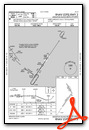
VFR Chart of PAMD
Sectional Charts at SkyVector.com
IFR Chart of PAMD
Enroute Charts at SkyVector.com
Location Information for PAMD
Coordinates: N59°27.00' / W146°18.43'Located 01 miles S of Middleton Island, Alaska on 5500 acres of land. View all Airports in Alaska.
Surveyed Elevation is 100 feet MSL.
Operations Data
|
|
Airport Communications
| AWOS-3P: | 135.725 Tel. 907-269-2855 |
|---|---|
| CTAF: | 122.900 |
| AWOS-3P at C05 (63.6 NW): | 129.05 907-573-5002 |
- APCH/DEP SVC PRVDD BY ANCHORAGE ARTCC ON FREQ 133.6/269.4 (MIDDLETON ISLAND RCAG).
- COMMUNICATIONS PRVDD BY JUNEAU FSS ON FREQ 122.05 (MIDDLETON ISLAND RCO).
Nearby Navigation Aids
|
| ||||||||||||||||||

Runway 02/20
DOWN SLOPE TO S. SAFETY AREAS SOFT. | ||
| Dimensions: | 3158 x 115 feet / 963 x 35 meters | |
|---|---|---|
| Surface: | Gravel in Good Condition | |
| Runway 02 | Runway 20 | |
| Coordinates: | N59°26.65' / W146°18.77' | N59°27.08' / W146°18.20' |
| Elevation: | 100.1 | 100.4 |
| Traffic Pattern: | Left | Left |
| Runway Heading: | 34° True | 214° True |
| Markings: | in poor condition. | in poor condition. |
| Obstacles: | 15 ft Road 0 ft from runway, 94 ft left of center | 15 ft Road 0 ft from runway, 84 ft right of center |
Runway 13/31
CLSD INDEFLY. MAINT NA. GRASS & ROCKS ON RWY. | ||
| Dimensions: | 1500 x 125 feet / 457 x 38 meters | |
|---|---|---|
| Surface: | Turf-Dirt in Failed Condition | |
| Runway 13 | Runway 31 | |
| Coordinates: | N59°27.38' / W146°18.45' | N59°27.16' / W146°18.21' |
| Elevation: | 98.9 | 96.8 |
| Traffic Pattern: | Left | Left |
| Runway Heading: | 149° True | 329° True |
| Obstacles: | 15 ft Road 0 ft from runway, 74 ft right of center | 15 ft Road 0 ft from runway, 90 ft left of center |
Ownership Information
| Ownership: | Publicly owned | |
|---|---|---|
| Owner: | FAA-KENAI SUPPORT CENTER | |
| 427 N. WILLOW ST. | ||
| KENAI, AK 99611 | ||
| 907-283-4526 | ||
| Manager: | US GOV, FAA KENAI SSC | |
| 427 N. WILLOW ST. | ||
| KENAI, AK 99611 | ||
| 907-283-4526 | ||
Other Remarks
- WX CAMERA ON RWY EDGE. WX CAMERA AVBL ON INTERNET AT HTTPS://WEATHERCAMS.FAA.GOV
- WATERFOWL & WILDLIFE INVOF OF RWYS.
- CTN: EAGLE NEST ON APCH. ELEC TRANSFORMER WI SAFETY AREA APCH END.
- 2 FT BRUSH APCH END.
- CONES.
- CONES.
- CONES.
- CONES.
Weather Minimums

Instrument Approach Procedure (IAP) Charts


Nearby Airports with Instrument Procedures
| ID | Name | Heading / Distance | ||
|---|---|---|---|---|
 |
PACV | Merle K (Mudhole) Smith Airport | 021° | 67.5 |
|
PAKA | Tatitlek Airport | 352° | 86.3 |
|
PAVD | Valdez Pioneer Field Airport | 001° | 101.3 |
Airport Images
Do you have a recent image of this airport? Upload it here!


