Login
Register


MMTM
Gral. Francisco Javier Mina Airport
VFR Chart of MMTM
Sectional Charts at SkyVector.com
IFR Chart of MMTM
Enroute Charts at SkyVector.com
Location Information for MMTM
Coordinates: N22°17.39' / W97°51.86'View all Airports in Tamaulipas, Mexico.
Elevation is 80.0 feet MSL.
Operations Data
|
|
Airport Communications
| PROXIMACION TAMPICO Approach: | 120.30 |
|---|---|
| TORRE TAMPICO Tower: | 118.30 |
Nearby Navigation Aids
|
| ||||||||||||||||||||||||||||||||||||

Runway 13/31
| Dimensions: | 8366 x 148 feet / 2550 x 45 meters | |
|---|---|---|
| Surface: | Hard | |
| Runway 13 | Runway 31 | |
| Coordinates: | N22°18.12' / W97°52.45' | N22°16.99' / W97°51.60' |
| Elevation: | 80 | 74 |
| Runway Heading: | 139° | 319° |
Runway 18/36
| Dimensions: | 4009 x 98 feet / 1222 x 30 meters | |
|---|---|---|
| Surface: | Unknown | |
| Runway 18 | Runway 36 | |
| Coordinates: | N22°18.03' / W97°51.74' | N22°17.39' / W97°51.86' |
| Elevation: | 45 | 71 |
| Runway Heading: | 185° | 005° |
Runway 09/27
| Dimensions: | 3937 x 98 feet / 1200 x 30 meters | |
|---|---|---|
| Surface: | Unknown | |
| Runway 09 | Runway 27 | |
| Coordinates: | N22°18.15' / W97°52.39' | N22°18.04' / W97°51.71' |
| Elevation: | 77 | 44 |
| Runway Heading: | 094° | 274° |
Nearby Airports with Instrument Procedures
| ID | Name | Heading / Distance | ||
|---|---|---|---|---|
 |
MMTN | Tamuin Airport | 254° | 54.6 |
|
MMPA | Poza Rica Airport | 167° | 103.4 |
|
MMCV | Gral. Pedro Jose Mendez International Airport | 324° | 103.9 |
|
MMQT | Intercontinental De Queretaro Airport | 232° | 163.9 |
Airport Images
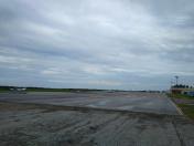
By: Meugniot09


