Login
Register


MYU
Mekoryuk Airport
Official FAA Data Effective 2026-02-19 0901Z
Chart Supplement

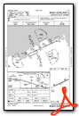
VFR Chart of PAMY
Sectional Charts at SkyVector.com
IFR Chart of PAMY
Enroute Charts at SkyVector.com
Location Information for PAMY
Coordinates: N60°22.34' / W166°16.21'Located 03 miles W of Mekoryuk, Alaska on 575 acres of land. View all Airports in Alaska.
Surveyed Elevation is 53 feet MSL.
Operations Data
|
|
Airport Communications
| AWOS-3P: | 123.9 Tel. 907-621-7972 |
|---|---|
| CTAF: | 122.900 |
| AWOS-3P at 4KA (32.5 E): | 118.25 907-269-2788 |
| AWOS-3P at OOK (36.3 E): | 119.275 907-560-7620 |
- APCH/DEP SVC PRVDD BY ANCHORAGE ARTCC ON FREQS 124.5/372.0 (CAPE ROMANZOF RCAG/BETHEL RCAG).
- COMMUNICATIONS PRVDD BY KENAI FSS ON FREQ 122.0 (MEKORYUK RCO).
Nearby Navigation Aids
|
| ||||||||||||
Runway 06/24
| Dimensions: | 3001 x 75 feet / 915 x 23 meters | |
|---|---|---|
| Surface: | Gravel in Good Condition SHALLOW RUTS WITH PONDING AFT RAIN. | |
| Edge Lighting: | Medium Intensity | |
| Runway 06 | Runway 24 | |
| Coordinates: | N60°22.24' / W166°16.66' | N60°22.45' / W166°15.76' |
| Elevation: | 53.3 | 52.4 |
| Traffic Pattern: | Left | Left |
| Runway Heading: | 65° True | 245° True |
| Markings: | Non-Standard in fair condition. | Non-Standard in fair condition. |
| Glide Slope Indicator | V4L (3.00° Glide Path Angle) | V4R (3.00° Glide Path Angle) |
| Obstacles: | 15 ft Road ft from runway, 65 ft left of center CTLG OBSTN EXCEEDS 45 DEG SLOPE. |
15 ft Road ft from runway, 65 ft right of center |
Ownership Information
| Ownership: | Publicly owned | |
|---|---|---|
| Owner: | ALASKA DOT&PF CENTRAL REGION | |
| PO BOX 196900 | ||
| ANCHORAGE, AK 99519-6900 | ||
| (907) 269-0749 | ||
| Manager: | NICK NORWOOD | |
| BOX 505 | ||
| BETHEL, AK 99559 | ||
| (907) 543-2498 | ||
Other Remarks
- WILDLIFE ON RWY.
- RWY COND UNMNT; RCMD VISUAL INSP PRIOR TO USE.
- WX CAMERA AVBL ON INTERNET AT HTTPS://WEATHERCAMS.FAA.GOV
- REFLECTIVE CONES & THR PANELS.
- REFLECTIVE CONES & THR PANELS.
- ACTVT VASI RWY 06 & 24; MIRL RWY 06/24 - CTAF.
Weather Minimums

Instrument Approach Procedure (IAP) Charts

Nearby Airports with Instrument Procedures
| ID | Name | Heading / Distance | ||
|---|---|---|---|---|
 |
POKA | Tununak Airport | 068° | 32.6 |
|
PAOO | Toksook Bay Airport | 073° | 36.6 |
|
PAHP | Hooper Bay Airport | 002° | 69.4 |
|
PAKI | Kipnuk Airport | 110° | 72.3 |
|
PAVA | Chevak Airport | 015° | 73.0 |
|
PACM | Scammon Bay Airport | 012° | 90.9 |
|
PAMO | Mountain Village Airport | 034° | 127.9 |
|
PASM | St Mary's Airport | 038° | 133.2 |
Airport Images

By: Priam


